You are here: Home > Network List > GS - US Geological Survey Networks Stations List
> Station KAN08 Pence Farm, Harper, KS, USA > Earthquake Result Viewer
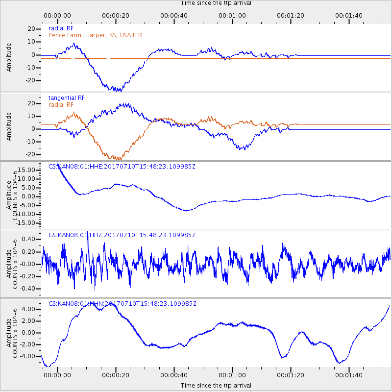
KAN08 Pence Farm, Harper, KS, USA - Earthquake Result Viewer
*The percent match for this event was below the threshold and hence no stack was calculated.
| Earthquake location: |
Southeast Of Easter Island |
| Earthquake latitude/longitude: |
-36.2/-100.6 |
| Earthquake time(UTC): |
2017/07/10 (191) 15:37:24 GMT |
| Earthquake Depth: |
10 km |
| Earthquake Magnitude: |
5.5 Mwb |
| Earthquake Catalog/Contributor: |
NEIC PDE/us |
|
| Network: |
GS US Geological Survey Networks |
| Station: |
KAN08 Pence Farm, Harper, KS, USA |
| Lat/Lon: |
37.23 N/97.97 W |
| Elevation: |
375 m |
|
| Distance: |
73.1 deg |
| Az: |
2.208 deg |
| Baz: |
182.239 deg |
| Ray Param: |
$rayparam |
*The percent match for this event was below the threshold and hence was not used in the summary stack. |
|
| Radial Match: |
72.077156 % |
| Radial Bump: |
400 |
| Transverse Match: |
66.41529 % |
| Transverse Bump: |
400 |
| SOD ConfigId: |
2140511 |
| Insert Time: |
2017-07-24 07:36:48.730 +0000 |
| GWidth: |
2.5 |
| Max Bumps: |
400 |
| Tol: |
0.001 |
|
Signal To Noise
| Channel | StoN | STA | LTA |
| GS:KAN08:01:HHZ:20170710T15:48:23.109985Z | 1.1909475 | 1.567419E-7 | 1.3161109E-7 |
| GS:KAN08:01:HHN:20170710T15:48:23.109985Z | 0.7670108 | 4.240998E-6 | 5.5292544E-6 |
| GS:KAN08:01:HHE:20170710T15:48:23.109985Z | 1.0070597 | 3.823196E-6 | 3.7963946E-6 |
| Arrivals |
| Ps | |
| PpPs | |
| PsPs/PpSs | |


