You are here: Home > Network List > CN - Canadian National Seismograph Network Stations List
> Station INK INUVIK, NT > Earthquake Result Viewer
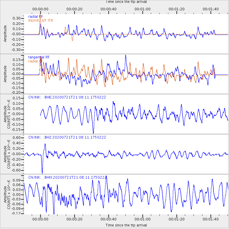
INK INUVIK, NT - Earthquake Result Viewer
*The percent match for this event was below the threshold and hence no stack was calculated.
| Earthquake location: |
Fiji Islands Region |
| Earthquake latitude/longitude: |
-20.8/-178.6 |
| Earthquake time(UTC): |
2020/07/21 (203) 20:56:24 GMT |
| Earthquake Depth: |
602 km |
| Earthquake Magnitude: |
6.0 mww |
| Earthquake Catalog/Contributor: |
NEIC PDE/us |
|
| Network: |
CN Canadian National Seismograph Network |
| Station: |
INK INUVIK, NT |
| Lat/Lon: |
68.31 N/133.53 W |
| Elevation: |
44 m |
|
| Distance: |
94.7 deg |
| Az: |
15.308 deg |
| Baz: |
221.624 deg |
| Ray Param: |
$rayparam |
*The percent match for this event was below the threshold and hence was not used in the summary stack. |
|
| Radial Match: |
60.28019 % |
| Radial Bump: |
400 |
| Transverse Match: |
46.452576 % |
| Transverse Bump: |
400 |
| SOD ConfigId: |
21709731 |
| Insert Time: |
2020-08-04 21:07:44.771 +0000 |
| GWidth: |
2.5 |
| Max Bumps: |
400 |
| Tol: |
0.001 |
|
Signal To Noise
| Channel | StoN | STA | LTA |
| CN:INK: :BHZ:20200721T21:08:11.175022Z | 5.159255 | 2.4138137E-7 | 4.6786095E-8 |
| CN:INK: :BHN:20200721T21:08:11.175022Z | 1.0373878 | 5.092305E-8 | 4.908776E-8 |
| CN:INK: :BHE:20200721T21:08:11.175022Z | 1.4170749 | 7.073663E-8 | 4.9917354E-8 |
| Arrivals |
| Ps | |
| PpPs | |
| PsPs/PpSs | |


