You are here: Home > Network List > GS - US Geological Survey Networks Stations List
> Station OK051 E0350 and S34600 Roads, Ralston, OK > Earthquake Result Viewer
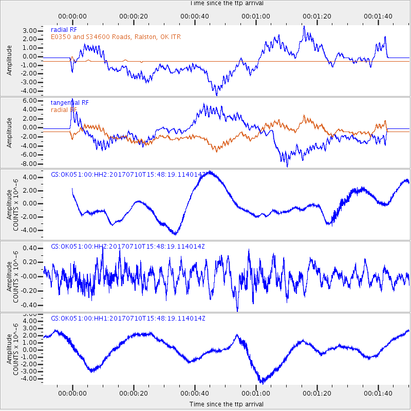
OK051 E0350 and S34600 Roads, Ralston, OK - Earthquake Result Viewer
*The percent match for this event was below the threshold and hence no stack was calculated.
| Earthquake location: |
Southeast Of Easter Island |
| Earthquake latitude/longitude: |
-36.2/-100.6 |
| Earthquake time(UTC): |
2017/07/10 (191) 15:37:24 GMT |
| Earthquake Depth: |
10 km |
| Earthquake Magnitude: |
5.5 Mwb |
| Earthquake Catalog/Contributor: |
NEIC PDE/us |
|
| Network: |
GS US Geological Survey Networks |
| Station: |
OK051 E0350 and S34600 Roads, Ralston, OK |
| Lat/Lon: |
36.51 N/96.84 W |
| Elevation: |
263 m |
|
| Distance: |
72.4 deg |
| Az: |
3.196 deg |
| Baz: |
183.21 deg |
| Ray Param: |
$rayparam |
*The percent match for this event was below the threshold and hence was not used in the summary stack. |
|
| Radial Match: |
30.440552 % |
| Radial Bump: |
400 |
| Transverse Match: |
59.72677 % |
| Transverse Bump: |
400 |
| SOD ConfigId: |
2140511 |
| Insert Time: |
2017-07-24 07:37:06.179 +0000 |
| GWidth: |
2.5 |
| Max Bumps: |
400 |
| Tol: |
0.001 |
|
Signal To Noise
| Channel | StoN | STA | LTA |
| GS:OK051:00:HHZ:20170710T15:48:19.114014Z | 1.0101826 | 1.1459393E-7 | 1.1343883E-7 |
| GS:OK051:00:HH1:20170710T15:48:19.114014Z | 0.51450086 | 1.1903148E-6 | 2.3135333E-6 |
| GS:OK051:00:HH2:20170710T15:48:19.114014Z | 2.4946802 | 2.7130575E-6 | 1.0875372E-6 |
| Arrivals |
| Ps | |
| PpPs | |
| PsPs/PpSs | |


