You are here: Home > Network List > G - GEOSCOPE Stations List
> Station INU Inuyama, Japan > Earthquake Result Viewer
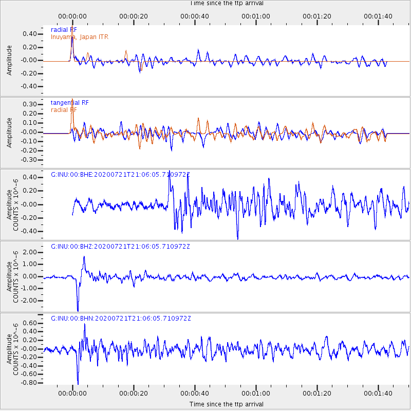
INU Inuyama, Japan - Earthquake Result Viewer
*The percent match for this event was below the threshold and hence no stack was calculated.
| Earthquake location: |
Fiji Islands Region |
| Earthquake latitude/longitude: |
-20.8/-178.6 |
| Earthquake time(UTC): |
2020/07/21 (203) 20:56:24 GMT |
| Earthquake Depth: |
602 km |
| Earthquake Magnitude: |
6.0 mww |
| Earthquake Catalog/Contributor: |
NEIC PDE/us |
|
| Network: |
G GEOSCOPE |
| Station: |
INU Inuyama, Japan |
| Lat/Lon: |
35.35 N/137.03 E |
| Elevation: |
132 m |
|
| Distance: |
70.0 deg |
| Az: |
322.497 deg |
| Baz: |
135.841 deg |
| Ray Param: |
$rayparam |
*The percent match for this event was below the threshold and hence was not used in the summary stack. |
|
| Radial Match: |
78.65667 % |
| Radial Bump: |
400 |
| Transverse Match: |
79.65703 % |
| Transverse Bump: |
400 |
| SOD ConfigId: |
21709731 |
| Insert Time: |
2020-08-04 21:08:48.859 +0000 |
| GWidth: |
2.5 |
| Max Bumps: |
400 |
| Tol: |
0.001 |
|
Signal To Noise
| Channel | StoN | STA | LTA |
| G:INU:00:BHZ:20200721T21:06:05.710972Z | 14.587652 | 9.799652E-7 | 6.7177716E-8 |
| G:INU:00:BHN:20200721T21:06:05.710972Z | 6.2522883 | 2.722521E-7 | 4.354439E-8 |
| G:INU:00:BHE:20200721T21:06:05.710972Z | 4.5058703 | 2.1144571E-7 | 4.692672E-8 |
| Arrivals |
| Ps | |
| PpPs | |
| PsPs/PpSs | |


