You are here: Home > Network List > TA - USArray Transportable Network (new EarthScope stations) Stations List
> Station D25K Kavik River, AK, USA > Earthquake Result Viewer
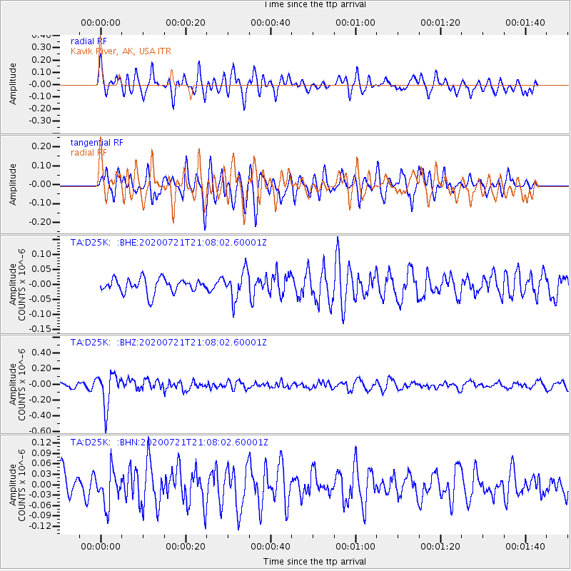
D25K Kavik River, AK, USA - Earthquake Result Viewer
*The percent match for this event was below the threshold and hence no stack was calculated.
| Earthquake location: |
Fiji Islands Region |
| Earthquake latitude/longitude: |
-20.8/-178.6 |
| Earthquake time(UTC): |
2020/07/21 (203) 20:56:24 GMT |
| Earthquake Depth: |
602 km |
| Earthquake Magnitude: |
6.0 mww |
| Earthquake Catalog/Contributor: |
NEIC PDE/us |
|
| Network: |
TA USArray Transportable Network (new EarthScope stations) |
| Station: |
D25K Kavik River, AK, USA |
| Lat/Lon: |
69.32 N/146.38 W |
| Elevation: |
770 m |
|
| Distance: |
92.8 deg |
| Az: |
10.923 deg |
| Baz: |
209.936 deg |
| Ray Param: |
$rayparam |
*The percent match for this event was below the threshold and hence was not used in the summary stack. |
|
| Radial Match: |
70.05588 % |
| Radial Bump: |
400 |
| Transverse Match: |
64.309525 % |
| Transverse Bump: |
400 |
| SOD ConfigId: |
21709731 |
| Insert Time: |
2020-08-04 21:15:43.890 +0000 |
| GWidth: |
2.5 |
| Max Bumps: |
400 |
| Tol: |
0.001 |
|
Signal To Noise
| Channel | StoN | STA | LTA |
| TA:D25K: :BHZ:20200721T21:08:02.60001Z | 5.15641 | 2.1414965E-7 | 4.1530765E-8 |
| TA:D25K: :BHN:20200721T21:08:02.60001Z | 1.6527245 | 5.0145378E-8 | 3.0341038E-8 |
| TA:D25K: :BHE:20200721T21:08:02.60001Z | 2.0033796 | 4.7023615E-8 | 2.3472145E-8 |
| Arrivals |
| Ps | |
| PpPs | |
| PsPs/PpSs | |


