You are here: Home > Network List > TA - USArray Transportable Network (new EarthScope stations) Stations List
> Station E20K Nigu River, AK, USA > Earthquake Result Viewer
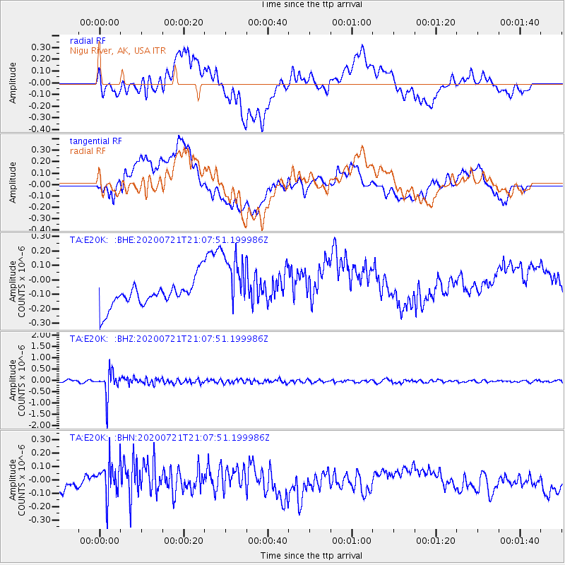
E20K Nigu River, AK, USA - Earthquake Result Viewer
*The percent match for this event was below the threshold and hence no stack was calculated.
| Earthquake location: |
Fiji Islands Region |
| Earthquake latitude/longitude: |
-20.8/-178.6 |
| Earthquake time(UTC): |
2020/07/21 (203) 20:56:24 GMT |
| Earthquake Depth: |
602 km |
| Earthquake Magnitude: |
6.0 mww |
| Earthquake Catalog/Contributor: |
NEIC PDE/us |
|
| Network: |
TA USArray Transportable Network (new EarthScope stations) |
| Station: |
E20K Nigu River, AK, USA |
| Lat/Lon: |
68.26 N/156.19 W |
| Elevation: |
866 m |
|
| Distance: |
90.3 deg |
| Az: |
8.157 deg |
| Baz: |
200.868 deg |
| Ray Param: |
$rayparam |
*The percent match for this event was below the threshold and hence was not used in the summary stack. |
|
| Radial Match: |
53.247406 % |
| Radial Bump: |
400 |
| Transverse Match: |
42.196823 % |
| Transverse Bump: |
400 |
| SOD ConfigId: |
21709731 |
| Insert Time: |
2020-08-04 21:15:52.117 +0000 |
| GWidth: |
2.5 |
| Max Bumps: |
400 |
| Tol: |
0.001 |
|
Signal To Noise
| Channel | StoN | STA | LTA |
| TA:E20K: :BHZ:20200721T21:07:51.199986Z | 7.9139433 | 5.5292696E-7 | 6.986743E-8 |
| TA:E20K: :BHN:20200721T21:07:51.199986Z | 1.3598555 | 1.2839529E-7 | 9.4418326E-8 |
| TA:E20K: :BHE:20200721T21:07:51.199986Z | 2.3327203 | 2.104239E-7 | 9.020537E-8 |
| Arrivals |
| Ps | |
| PpPs | |
| PsPs/PpSs | |


