You are here: Home > Network List > TA - USArray Transportable Network (new EarthScope stations) Stations List
> Station H31M Peel River, Yukon, CAN > Earthquake Result Viewer
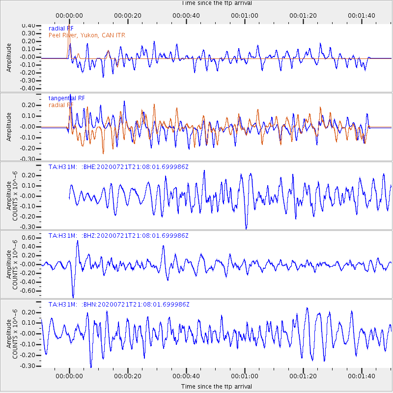
H31M Peel River, Yukon, CAN - Earthquake Result Viewer
*The percent match for this event was below the threshold and hence no stack was calculated.
| Earthquake location: |
Fiji Islands Region |
| Earthquake latitude/longitude: |
-20.8/-178.6 |
| Earthquake time(UTC): |
2020/07/21 (203) 20:56:24 GMT |
| Earthquake Depth: |
602 km |
| Earthquake Magnitude: |
6.0 mww |
| Earthquake Catalog/Contributor: |
NEIC PDE/us |
|
| Network: |
TA USArray Transportable Network (new EarthScope stations) |
| Station: |
H31M Peel River, Yukon, CAN |
| Lat/Lon: |
65.81 N/134.34 W |
| Elevation: |
642 m |
|
| Distance: |
92.6 deg |
| Az: |
16.725 deg |
| Baz: |
220.781 deg |
| Ray Param: |
$rayparam |
*The percent match for this event was below the threshold and hence was not used in the summary stack. |
|
| Radial Match: |
67.163826 % |
| Radial Bump: |
400 |
| Transverse Match: |
66.837006 % |
| Transverse Bump: |
400 |
| SOD ConfigId: |
21709731 |
| Insert Time: |
2020-08-04 21:16:52.803 +0000 |
| GWidth: |
2.5 |
| Max Bumps: |
400 |
| Tol: |
0.001 |
|
Signal To Noise
| Channel | StoN | STA | LTA |
| TA:H31M: :BHZ:20200721T21:08:01.699986Z | 5.085772 | 3.0854665E-7 | 6.066859E-8 |
| TA:H31M: :BHN:20200721T21:08:01.699986Z | 0.60316116 | 4.6184486E-8 | 7.657072E-8 |
| TA:H31M: :BHE:20200721T21:08:01.699986Z | 1.690928 | 1.1264433E-7 | 6.661687E-8 |
| Arrivals |
| Ps | |
| PpPs | |
| PsPs/PpSs | |


