You are here: Home > Network List > TA - USArray Transportable Network (new EarthScope stations) Stations List
> Station I30M Mount Dempster, Yukon, CAN > Earthquake Result Viewer
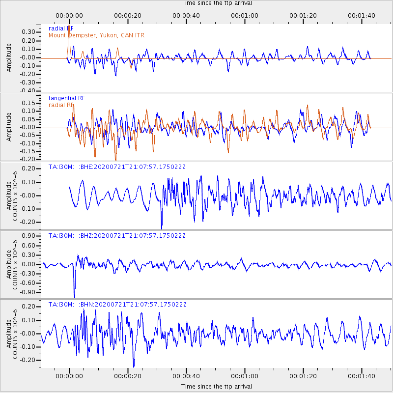
I30M Mount Dempster, Yukon, CAN - Earthquake Result Viewer
*The percent match for this event was below the threshold and hence no stack was calculated.
| Earthquake location: |
Fiji Islands Region |
| Earthquake latitude/longitude: |
-20.8/-178.6 |
| Earthquake time(UTC): |
2020/07/21 (203) 20:56:24 GMT |
| Earthquake Depth: |
602 km |
| Earthquake Magnitude: |
6.0 mww |
| Earthquake Catalog/Contributor: |
NEIC PDE/us |
|
| Network: |
TA USArray Transportable Network (new EarthScope stations) |
| Station: |
I30M Mount Dempster, Yukon, CAN |
| Lat/Lon: |
65.22 N/136.38 W |
| Elevation: |
1399 m |
|
| Distance: |
91.6 deg |
| Az: |
16.449 deg |
| Baz: |
218.943 deg |
| Ray Param: |
$rayparam |
*The percent match for this event was below the threshold and hence was not used in the summary stack. |
|
| Radial Match: |
51.695736 % |
| Radial Bump: |
400 |
| Transverse Match: |
50.68272 % |
| Transverse Bump: |
400 |
| SOD ConfigId: |
21709731 |
| Insert Time: |
2020-08-04 21:16:58.534 +0000 |
| GWidth: |
2.5 |
| Max Bumps: |
400 |
| Tol: |
0.001 |
|
Signal To Noise
| Channel | StoN | STA | LTA |
| TA:I30M: :BHZ:20200721T21:07:57.175022Z | 4.2526245 | 2.9883324E-7 | 7.027032E-8 |
| TA:I30M: :BHN:20200721T21:07:57.175022Z | 1.7080649 | 6.9743415E-8 | 4.083183E-8 |
| TA:I30M: :BHE:20200721T21:07:57.175022Z | 1.6014457 | 7.8860175E-8 | 4.9243116E-8 |
| Arrivals |
| Ps | |
| PpPs | |
| PsPs/PpSs | |


