You are here: Home > Network List > TA - USArray Transportable Network (new EarthScope stations) Stations List
> Station M16K Timber Creek, AK, USA > Earthquake Result Viewer
M16K Timber Creek, AK, USA - Earthquake Result Viewer
*The percent match for this event was below the threshold and hence no stack was calculated.
| Earthquake location: |
Fiji Islands Region |
| Earthquake latitude/longitude: |
-20.8/-178.6 |
| Earthquake time(UTC): |
2020/07/21 (203) 20:56:24 GMT |
| Earthquake Depth: |
602 km |
| Earthquake Magnitude: |
6.0 mww |
| Earthquake Catalog/Contributor: |
NEIC PDE/us |
|
| Network: |
TA USArray Transportable Network (new EarthScope stations) |
| Station: |
M16K Timber Creek, AK, USA |
| Lat/Lon: |
61.02 N/158.96 W |
| Elevation: |
394 m |
|
| Distance: |
83.1 deg |
| Az: |
9.477 deg |
| Baz: |
198.438 deg |
| Ray Param: |
$rayparam |
*The percent match for this event was below the threshold and hence was not used in the summary stack. |
|
| Radial Match: |
63.558456 % |
| Radial Bump: |
400 |
| Transverse Match: |
73.708755 % |
| Transverse Bump: |
400 |
| SOD ConfigId: |
21709731 |
| Insert Time: |
2020-08-04 21:17:24.082 +0000 |
| GWidth: |
2.5 |
| Max Bumps: |
400 |
| Tol: |
0.001 |
|
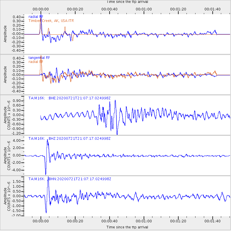
Signal To Noise
| Channel | StoN | STA | LTA |
| TA:M16K: :BHZ:20200721T21:07:17.024998Z | 28.207184 | 2.1938454E-6 | 7.777613E-8 |
| TA:M16K: :BHN:20200721T21:07:17.024998Z | 5.5951586 | 8.4809585E-7 | 1.5157671E-7 |
| TA:M16K: :BHE:20200721T21:07:17.024998Z | 2.1817079 | 2.9756964E-7 | 1.36393E-7 |
| Arrivals |
| Ps | |
| PpPs | |
| PsPs/PpSs | |


