You are here: Home > Network List > US - United States National Seismic Network Stations List
> Station EGMT Eagleton, Montana, USA > Earthquake Result Viewer
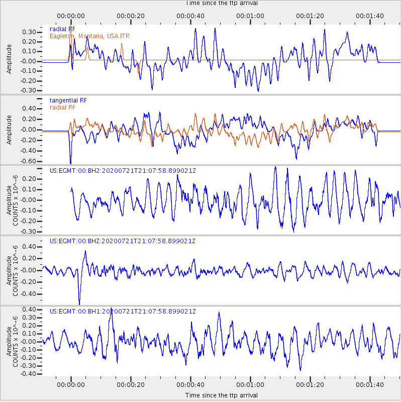
EGMT Eagleton, Montana, USA - Earthquake Result Viewer
*The percent match for this event was below the threshold and hence no stack was calculated.
| Earthquake location: |
Fiji Islands Region |
| Earthquake latitude/longitude: |
-20.8/-178.6 |
| Earthquake time(UTC): |
2020/07/21 (203) 20:56:24 GMT |
| Earthquake Depth: |
602 km |
| Earthquake Magnitude: |
6.0 mww |
| Earthquake Catalog/Contributor: |
NEIC PDE/us |
|
| Network: |
US United States National Seismic Network |
| Station: |
EGMT Eagleton, Montana, USA |
| Lat/Lon: |
48.02 N/109.75 W |
| Elevation: |
1055 m |
|
| Distance: |
92.0 deg |
| Az: |
38.78 deg |
| Baz: |
240.78 deg |
| Ray Param: |
$rayparam |
*The percent match for this event was below the threshold and hence was not used in the summary stack. |
|
| Radial Match: |
33.021255 % |
| Radial Bump: |
400 |
| Transverse Match: |
58.162987 % |
| Transverse Bump: |
400 |
| SOD ConfigId: |
21709731 |
| Insert Time: |
2020-08-04 21:20:22.958 +0000 |
| GWidth: |
2.5 |
| Max Bumps: |
400 |
| Tol: |
0.001 |
|
Signal To Noise
| Channel | StoN | STA | LTA |
| US:EGMT:00:BHZ:20200721T21:07:58.899021Z | 3.278717 | 2.0452633E-7 | 6.237998E-8 |
| US:EGMT:00:BH1:20200721T21:07:58.899021Z | 0.6367198 | 6.875443E-8 | 1.07982245E-7 |
| US:EGMT:00:BH2:20200721T21:07:58.899021Z | 1.7441128 | 1.2690407E-7 | 7.276138E-8 |
| Arrivals |
| Ps | |
| PpPs | |
| PsPs/PpSs | |


