You are here: Home > Network List > UW - Pacific Northwest Regional Seismic Network Stations List
> Station IRON Crane, OR, USA > Earthquake Result Viewer
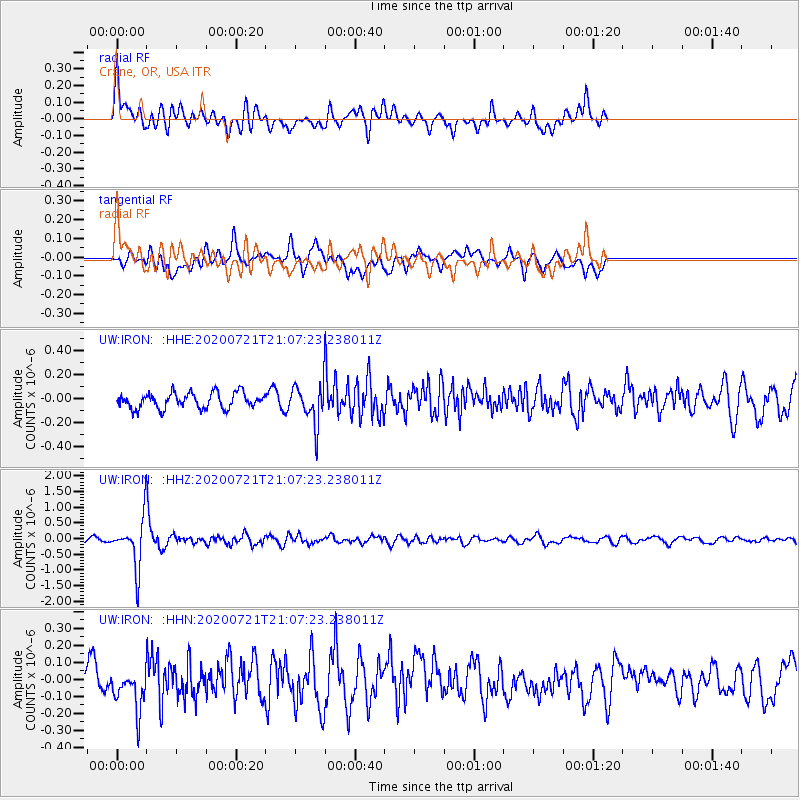
IRON Crane, OR, USA - Earthquake Result Viewer
*The percent match for this event was below the threshold and hence no stack was calculated.
| Earthquake location: |
Fiji Islands Region |
| Earthquake latitude/longitude: |
-20.8/-178.6 |
| Earthquake time(UTC): |
2020/07/21 (203) 20:56:24 GMT |
| Earthquake Depth: |
602 km |
| Earthquake Magnitude: |
6.0 mww |
| Earthquake Catalog/Contributor: |
NEIC PDE/us |
|
| Network: |
UW Pacific Northwest Regional Seismic Network |
| Station: |
IRON Crane, OR, USA |
| Lat/Lon: |
43.36 N/118.47 W |
| Elevation: |
1226 m |
|
| Distance: |
84.4 deg |
| Az: |
39.446 deg |
| Baz: |
234.571 deg |
| Ray Param: |
$rayparam |
*The percent match for this event was below the threshold and hence was not used in the summary stack. |
|
| Radial Match: |
66.58829 % |
| Radial Bump: |
400 |
| Transverse Match: |
48.536472 % |
| Transverse Bump: |
400 |
| SOD ConfigId: |
21709731 |
| Insert Time: |
2020-08-04 21:22:09.215 +0000 |
| GWidth: |
2.5 |
| Max Bumps: |
400 |
| Tol: |
0.001 |
|
Signal To Noise
| Channel | StoN | STA | LTA |
| UW:IRON: :HHZ:20200721T21:07:23.238011Z | 11.783903 | 7.5256213E-7 | 6.3863574E-8 |
| UW:IRON: :HHN:20200721T21:07:23.238011Z | 1.9366841 | 1.2567612E-7 | 6.489242E-8 |
| UW:IRON: :HHE:20200721T21:07:23.238011Z | 2.398141 | 1.5488365E-7 | 6.458488E-8 |
| Arrivals |
| Ps | |
| PpPs | |
| PsPs/PpSs | |


