You are here: Home > Network List > GS - US Geological Survey Networks Stations List
> Station MT01 Lincoln Ranger Stn, Helena Natl Forest, Montana, USA > Earthquake Result Viewer
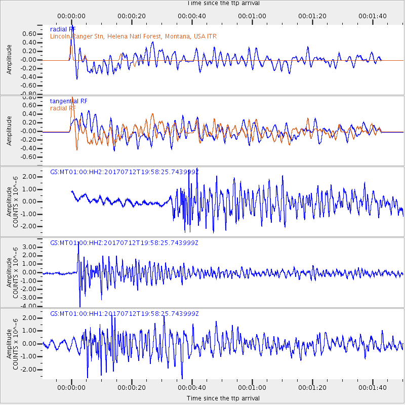
MT01 Lincoln Ranger Stn, Helena Natl Forest, Montana, USA - Earthquake Result Viewer
*The percent match for this event was below the threshold and hence no stack was calculated.
| Earthquake location: |
Sea Of Japan |
| Earthquake latitude/longitude: |
40.9/131.6 |
| Earthquake time(UTC): |
2017/07/12 (193) 19:48:07 GMT |
| Earthquake Depth: |
538 km |
| Earthquake Magnitude: |
5.8 Mww |
| Earthquake Catalog/Contributor: |
NEIC PDE/us |
|
| Network: |
GS US Geological Survey Networks |
| Station: |
MT01 Lincoln Ranger Stn, Helena Natl Forest, Montana, USA |
| Lat/Lon: |
46.95 N/112.66 W |
| Elevation: |
1318 m |
|
| Distance: |
75.6 deg |
| Az: |
39.595 deg |
| Baz: |
315.113 deg |
| Ray Param: |
$rayparam |
*The percent match for this event was below the threshold and hence was not used in the summary stack. |
|
| Radial Match: |
62.24185 % |
| Radial Bump: |
400 |
| Transverse Match: |
59.44854 % |
| Transverse Bump: |
400 |
| SOD ConfigId: |
2140511 |
| Insert Time: |
2017-07-26 11:44:37.155 +0000 |
| GWidth: |
2.5 |
| Max Bumps: |
400 |
| Tol: |
0.001 |
|
Signal To Noise
| Channel | StoN | STA | LTA |
| GS:MT01:00:HHZ:20170712T19:58:25.743999Z | 22.857998 | 1.3939654E-6 | 6.09837E-8 |
| GS:MT01:00:HH1:20170712T19:58:25.743999Z | 2.289991 | 4.963544E-7 | 2.1674951E-7 |
| GS:MT01:00:HH2:20170712T19:58:25.743999Z | 2.001108 | 5.179709E-7 | 2.5884205E-7 |
| Arrivals |
| Ps | |
| PpPs | |
| PsPs/PpSs | |


