You are here: Home > Network List > TA - USArray Transportable Network (new EarthScope stations) Stations List
> Station TUL3 Leonard, OK, USA > Earthquake Result Viewer
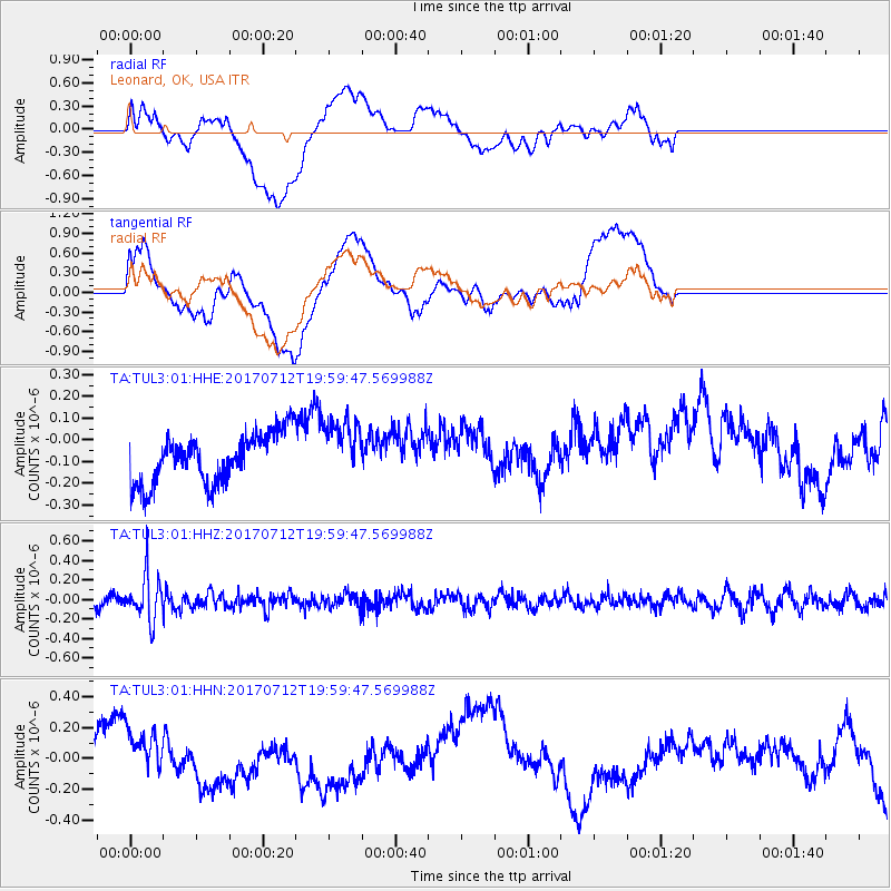
TUL3 Leonard, OK, USA - Earthquake Result Viewer
*The percent match for this event was below the threshold and hence no stack was calculated.
| Earthquake location: |
Sea Of Japan |
| Earthquake latitude/longitude: |
40.9/131.6 |
| Earthquake time(UTC): |
2017/07/12 (193) 19:48:07 GMT |
| Earthquake Depth: |
538 km |
| Earthquake Magnitude: |
5.8 Mww |
| Earthquake Catalog/Contributor: |
NEIC PDE/us |
|
| Network: |
TA USArray Transportable Network (new EarthScope stations) |
| Station: |
TUL3 Leonard, OK, USA |
| Lat/Lon: |
35.91 N/95.79 W |
| Elevation: |
265 m |
|
| Distance: |
92.1 deg |
| Az: |
36.741 deg |
| Baz: |
326.018 deg |
| Ray Param: |
$rayparam |
*The percent match for this event was below the threshold and hence was not used in the summary stack. |
|
| Radial Match: |
27.654829 % |
| Radial Bump: |
400 |
| Transverse Match: |
27.309288 % |
| Transverse Bump: |
400 |
| SOD ConfigId: |
2140511 |
| Insert Time: |
2017-07-26 11:49:40.189 +0000 |
| GWidth: |
2.5 |
| Max Bumps: |
400 |
| Tol: |
0.001 |
|
Signal To Noise
| Channel | StoN | STA | LTA |
| TA:TUL3:01:HHZ:20170712T19:59:47.569988Z | 3.1090894 | 2.1961682E-7 | 7.063702E-8 |
| TA:TUL3:01:HHN:20170712T19:59:47.569988Z | 0.9377872 | 1.5875E-7 | 1.6928146E-7 |
| TA:TUL3:01:HHE:20170712T19:59:47.569988Z | 1.2227764 | 1.389985E-7 | 1.13674496E-7 |
| Arrivals |
| Ps | |
| PpPs | |
| PsPs/PpSs | |


