You are here: Home > Network List > US - United States National Seismic Network Stations List
> Station CBKS Cedar Bluff, Kansas, USA > Earthquake Result Viewer
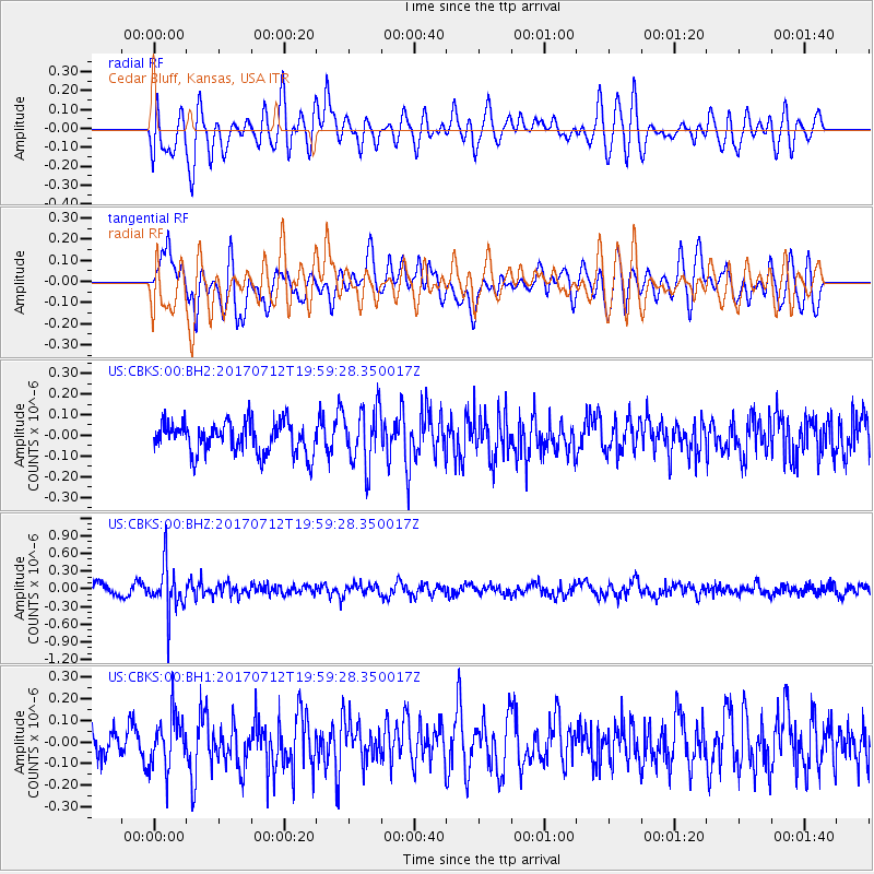
CBKS Cedar Bluff, Kansas, USA - Earthquake Result Viewer
*The percent match for this event was below the threshold and hence no stack was calculated.
| Earthquake location: |
Sea Of Japan |
| Earthquake latitude/longitude: |
40.9/131.6 |
| Earthquake time(UTC): |
2017/07/12 (193) 19:48:07 GMT |
| Earthquake Depth: |
538 km |
| Earthquake Magnitude: |
5.8 Mww |
| Earthquake Catalog/Contributor: |
NEIC PDE/us |
|
| Network: |
US United States National Seismic Network |
| Station: |
CBKS Cedar Bluff, Kansas, USA |
| Lat/Lon: |
38.81 N/99.74 W |
| Elevation: |
677 m |
|
| Distance: |
87.9 deg |
| Az: |
37.642 deg |
| Baz: |
323.633 deg |
| Ray Param: |
$rayparam |
*The percent match for this event was below the threshold and hence was not used in the summary stack. |
|
| Radial Match: |
50.89418 % |
| Radial Bump: |
400 |
| Transverse Match: |
59.553886 % |
| Transverse Bump: |
400 |
| SOD ConfigId: |
2140511 |
| Insert Time: |
2017-07-26 11:49:56.132 +0000 |
| GWidth: |
2.5 |
| Max Bumps: |
400 |
| Tol: |
0.001 |
|
Signal To Noise
| Channel | StoN | STA | LTA |
| US:CBKS:00:BHZ:20170712T19:59:28.350017Z | 4.133064 | 4.0197287E-7 | 9.7257846E-8 |
| US:CBKS:00:BH1:20170712T19:59:28.350017Z | 1.3338822 | 1.2477247E-7 | 9.354084E-8 |
| US:CBKS:00:BH2:20170712T19:59:28.350017Z | 1.8688413 | 1.42774E-7 | 7.639707E-8 |
| Arrivals |
| Ps | |
| PpPs | |
| PsPs/PpSs | |


