You are here: Home > Network List > US - United States National Seismic Network Stations List
> Station DGMT Dagmar, Montana, USA > Earthquake Result Viewer
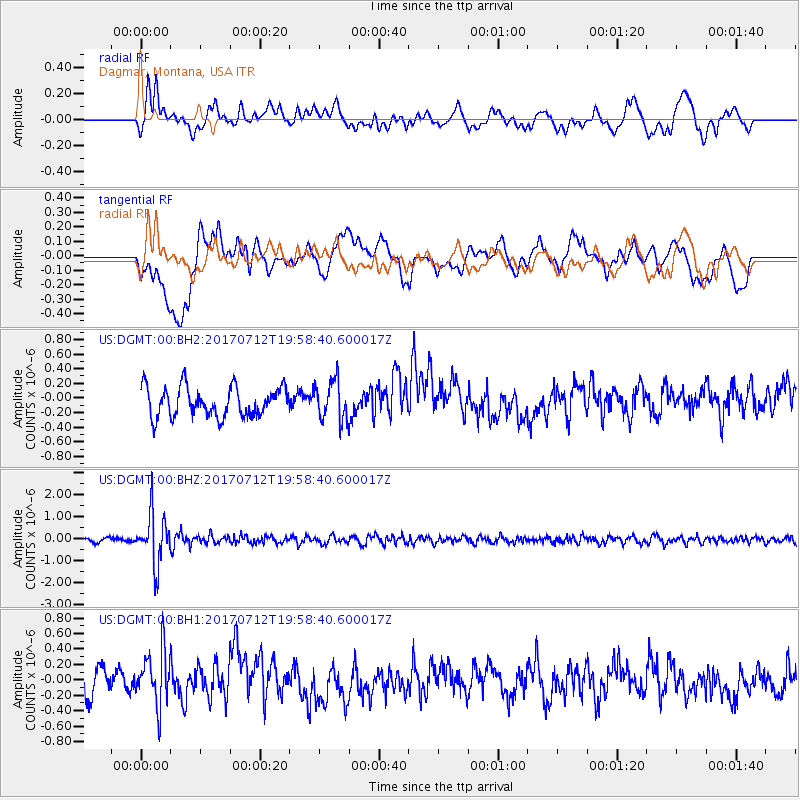
DGMT Dagmar, Montana, USA - Earthquake Result Viewer
*The percent match for this event was below the threshold and hence no stack was calculated.
| Earthquake location: |
Sea Of Japan |
| Earthquake latitude/longitude: |
40.9/131.6 |
| Earthquake time(UTC): |
2017/07/12 (193) 19:48:07 GMT |
| Earthquake Depth: |
538 km |
| Earthquake Magnitude: |
5.8 Mww |
| Earthquake Catalog/Contributor: |
NEIC PDE/us |
|
| Network: |
US United States National Seismic Network |
| Station: |
DGMT Dagmar, Montana, USA |
| Lat/Lon: |
48.47 N/104.20 W |
| Elevation: |
0.0 m |
|
| Distance: |
78.3 deg |
| Az: |
34.216 deg |
| Baz: |
320.141 deg |
| Ray Param: |
$rayparam |
*The percent match for this event was below the threshold and hence was not used in the summary stack. |
|
| Radial Match: |
59.025566 % |
| Radial Bump: |
400 |
| Transverse Match: |
48.675014 % |
| Transverse Bump: |
400 |
| SOD ConfigId: |
2140511 |
| Insert Time: |
2017-07-26 11:49:59.793 +0000 |
| GWidth: |
2.5 |
| Max Bumps: |
400 |
| Tol: |
0.001 |
|
Signal To Noise
| Channel | StoN | STA | LTA |
| US:DGMT:00:BHZ:20170712T19:58:40.600017Z | 11.086373 | 1.138543E-6 | 1.0269751E-7 |
| US:DGMT:00:BH1:20170712T19:58:40.600017Z | 1.8494909 | 3.5225705E-7 | 1.9046163E-7 |
| US:DGMT:00:BH2:20170712T19:58:40.600017Z | 1.3203282 | 2.6752045E-7 | 2.0261663E-7 |
| Arrivals |
| Ps | |
| PpPs | |
| PsPs/PpSs | |


