You are here: Home > Network List > US - United States National Seismic Network Stations List
> Station HDIL Hopedale, Illinois, USA > Earthquake Result Viewer
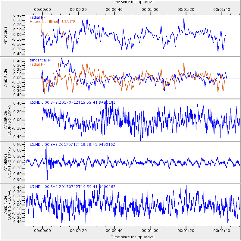
HDIL Hopedale, Illinois, USA - Earthquake Result Viewer
*The percent match for this event was below the threshold and hence no stack was calculated.
| Earthquake location: |
Sea Of Japan |
| Earthquake latitude/longitude: |
40.9/131.6 |
| Earthquake time(UTC): |
2017/07/12 (193) 19:48:07 GMT |
| Earthquake Depth: |
538 km |
| Earthquake Magnitude: |
5.8 Mww |
| Earthquake Catalog/Contributor: |
NEIC PDE/us |
|
| Network: |
US United States National Seismic Network |
| Station: |
HDIL Hopedale, Illinois, USA |
| Lat/Lon: |
40.56 N/89.29 W |
| Elevation: |
219 m |
|
| Distance: |
90.8 deg |
| Az: |
29.947 deg |
| Baz: |
330.201 deg |
| Ray Param: |
$rayparam |
*The percent match for this event was below the threshold and hence was not used in the summary stack. |
|
| Radial Match: |
32.448948 % |
| Radial Bump: |
400 |
| Transverse Match: |
33.440872 % |
| Transverse Bump: |
400 |
| SOD ConfigId: |
2140511 |
| Insert Time: |
2017-07-26 11:50:25.514 +0000 |
| GWidth: |
2.5 |
| Max Bumps: |
400 |
| Tol: |
0.001 |
|
Signal To Noise
| Channel | StoN | STA | LTA |
| US:HDIL:00:BHZ:20170712T19:59:41.949016Z | 3.2245586 | 3.0799416E-7 | 9.551514E-8 |
| US:HDIL:00:BH1:20170712T19:59:41.949016Z | 1.1015931 | 2.1069899E-7 | 1.9126753E-7 |
| US:HDIL:00:BH2:20170712T19:59:41.949016Z | 1.0842497 | 1.6078359E-7 | 1.4829017E-7 |
| Arrivals |
| Ps | |
| PpPs | |
| PsPs/PpSs | |


