You are here: Home > Network List > US - United States National Seismic Network Stations List
> Station MIAR Mount Ida, Arkansas, USA > Earthquake Result Viewer
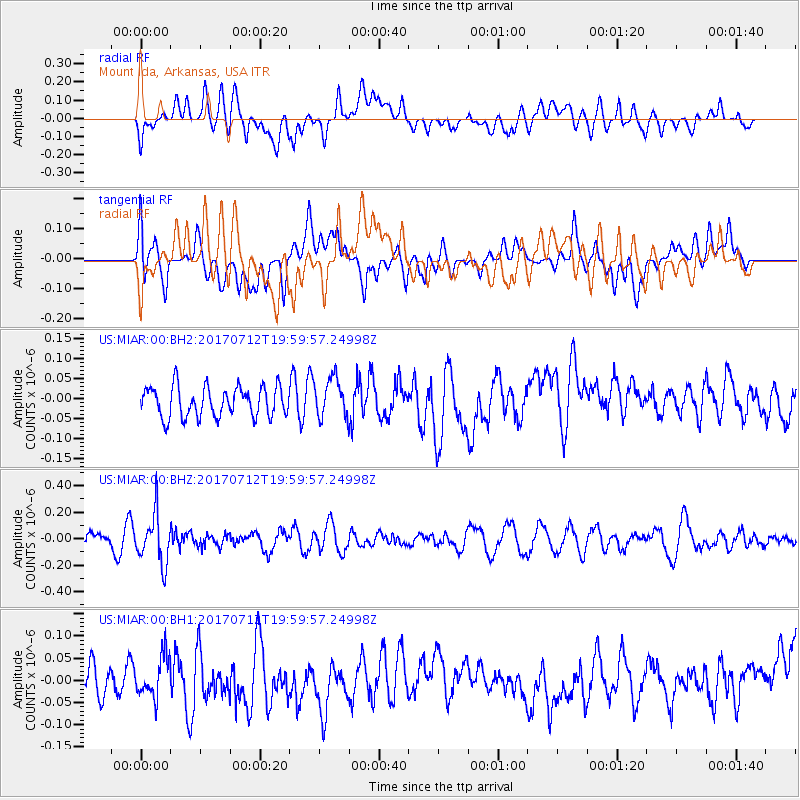
MIAR Mount Ida, Arkansas, USA - Earthquake Result Viewer
*The percent match for this event was below the threshold and hence no stack was calculated.
| Earthquake location: |
Sea Of Japan |
| Earthquake latitude/longitude: |
40.9/131.6 |
| Earthquake time(UTC): |
2017/07/12 (193) 19:48:07 GMT |
| Earthquake Depth: |
538 km |
| Earthquake Magnitude: |
5.8 Mww |
| Earthquake Catalog/Contributor: |
NEIC PDE/us |
|
| Network: |
US United States National Seismic Network |
| Station: |
MIAR Mount Ida, Arkansas, USA |
| Lat/Lon: |
34.55 N/93.58 W |
| Elevation: |
207 m |
|
| Distance: |
94.2 deg |
| Az: |
35.973 deg |
| Baz: |
327.332 deg |
| Ray Param: |
$rayparam |
*The percent match for this event was below the threshold and hence was not used in the summary stack. |
|
| Radial Match: |
56.124336 % |
| Radial Bump: |
400 |
| Transverse Match: |
46.145107 % |
| Transverse Bump: |
400 |
| SOD ConfigId: |
2140511 |
| Insert Time: |
2017-07-26 11:50:43.255 +0000 |
| GWidth: |
2.5 |
| Max Bumps: |
400 |
| Tol: |
0.001 |
|
Signal To Noise
| Channel | StoN | STA | LTA |
| US:MIAR:00:BHZ:20170712T19:59:57.24998Z | 3.317602 | 1.8453099E-7 | 5.56218E-8 |
| US:MIAR:00:BH1:20170712T19:59:57.24998Z | 1.3011801 | 4.6584667E-8 | 3.580186E-8 |
| US:MIAR:00:BH2:20170712T19:59:57.24998Z | 1.3239145 | 4.96751E-8 | 3.752138E-8 |
| Arrivals |
| Ps | |
| PpPs | |
| PsPs/PpSs | |


