
Y51 Y51 - Earthquake Result Viewer
| ||||||||||||||||||
| ||||||||||||||||||
| ||||||||||||||||||
|
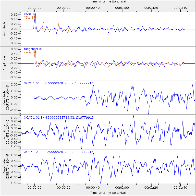
Signal To Noise
| Channel | StoN | STA | LTA |
| XC:Y51:01:BHN:20000928T23:32:13.977991Z | 1.1170363 | 1.7387279E-7 | 1.5565544E-7 |
| XC:Y51:01:BHE:20000928T23:32:13.977991Z | 1.3777518 | 2.396591E-7 | 1.7394939E-7 |
| XC:Y51:01:BHZ:20000928T23:32:13.977991Z | 1.3076835 | 1.781722E-7 | 1.3625025E-7 |
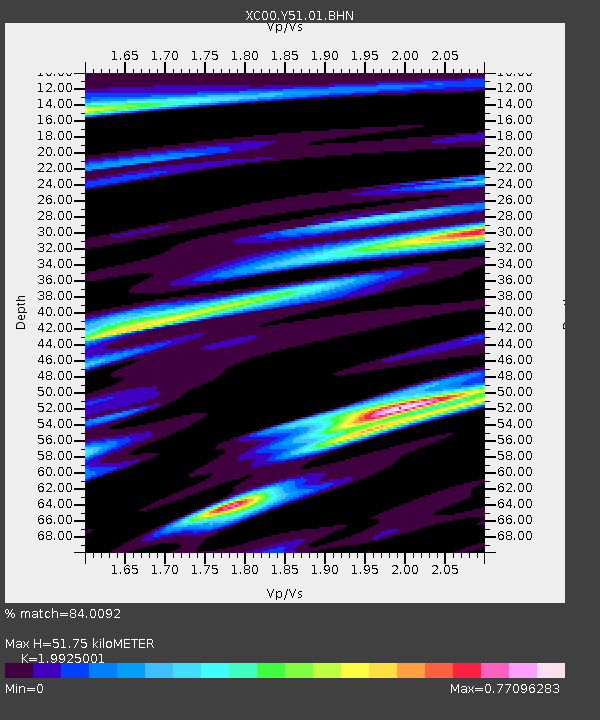
| Arrivals | |
| Ps | 8.6 SECOND |
| PpPs | 24 SECOND |
| PsPs/PpSs | 32 SECOND |

