
Y51 Y51 - Earthquake Result Viewer
| ||||||||||||||||||
| ||||||||||||||||||
| ||||||||||||||||||
|
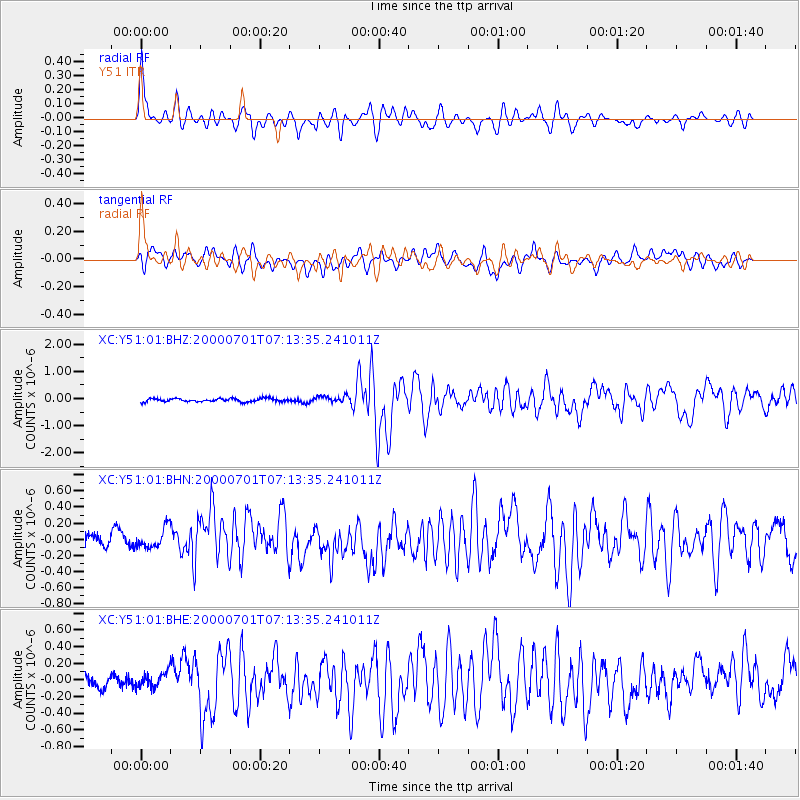
Signal To Noise
| Channel | StoN | STA | LTA |
| XC:Y51:01:BHN:20000701T07:13:35.241011Z | 1.2438493 | 1.4185365E-7 | 1.14044084E-7 |
| XC:Y51:01:BHE:20000701T07:13:35.241011Z | 1.3330383 | 1.00492386E-7 | 7.538597E-8 |
| XC:Y51:01:BHZ:20000701T07:13:35.241011Z | 1.9235823 | 1.2681396E-7 | 6.592593E-8 |
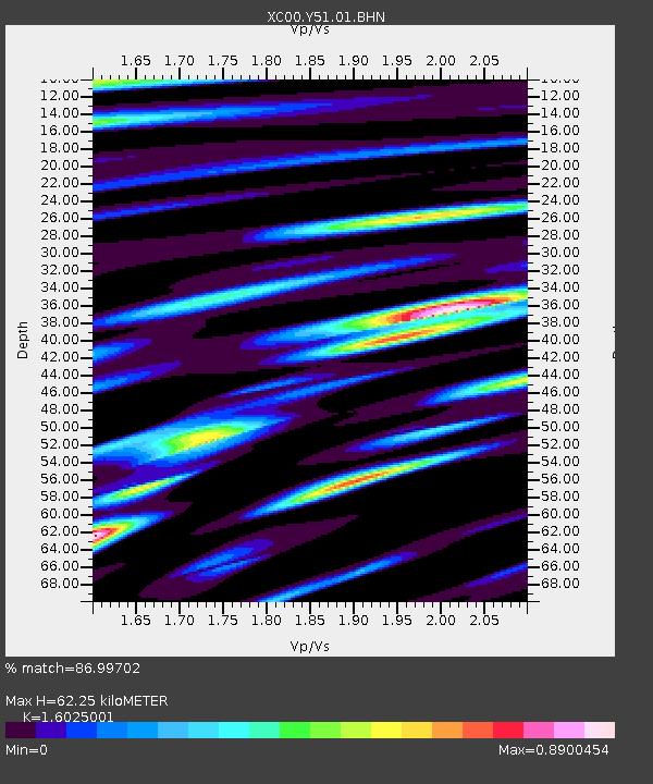
| Arrivals | |
| Ps | 6.2 SECOND |
| PpPs | 25 SECOND |
| PsPs/PpSs | 31 SECOND |

