You are here: Home > Network List > US - United States National Seismic Network Stations List
> Station EGMT Eagleton, Montana, USA > Earthquake Result Viewer
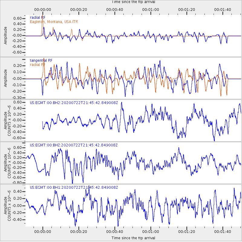
EGMT Eagleton, Montana, USA - Earthquake Result Viewer
*The percent match for this event was below the threshold and hence no stack was calculated.
| Earthquake location: |
Alaska Peninsula |
| Earthquake latitude/longitude: |
55.2/-159.3 |
| Earthquake time(UTC): |
2020/07/22 (204) 21:39:59 GMT |
| Earthquake Depth: |
39 km |
| Earthquake Magnitude: |
5.5 Mww |
| Earthquake Catalog/Contributor: |
NEIC PDE/us |
|
| Network: |
US United States National Seismic Network |
| Station: |
EGMT Eagleton, Montana, USA |
| Lat/Lon: |
48.02 N/109.75 W |
| Elevation: |
1055 m |
|
| Distance: |
31.0 deg |
| Az: |
82.449 deg |
| Baz: |
302.209 deg |
| Ray Param: |
$rayparam |
*The percent match for this event was below the threshold and hence was not used in the summary stack. |
|
| Radial Match: |
60.03842 % |
| Radial Bump: |
400 |
| Transverse Match: |
66.928474 % |
| Transverse Bump: |
400 |
| SOD ConfigId: |
21709731 |
| Insert Time: |
2020-08-05 21:57:41.016 +0000 |
| GWidth: |
2.5 |
| Max Bumps: |
400 |
| Tol: |
0.001 |
|
Signal To Noise
| Channel | StoN | STA | LTA |
| US:EGMT:00:BHZ:20200722T21:45:42.849008Z | 1.5323744 | 3.1993852E-7 | 2.0878613E-7 |
| US:EGMT:00:BH1:20200722T21:45:42.849008Z | 0.91689557 | 1.5688892E-7 | 1.7110882E-7 |
| US:EGMT:00:BH2:20200722T21:45:42.849008Z | 1.3290217 | 1.4488047E-7 | 1.09012866E-7 |
| Arrivals |
| Ps | |
| PpPs | |
| PsPs/PpSs | |


