You are here: Home > Network List > IW - Intermountain West Stations List
> Station MOOW Moose Ponds, Wyoming, USA > Earthquake Result Viewer
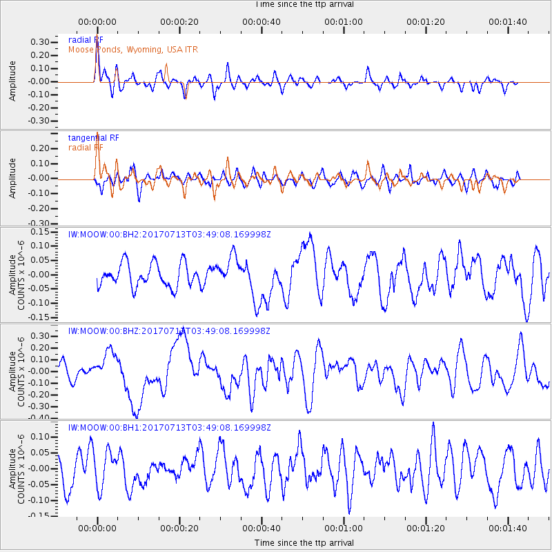
MOOW Moose Ponds, Wyoming, USA - Earthquake Result Viewer
*The percent match for this event was below the threshold and hence no stack was calculated.
| Earthquake location: |
New Ireland Region, P.N.G. |
| Earthquake latitude/longitude: |
-4.8/153.2 |
| Earthquake time(UTC): |
2017/07/13 (194) 03:36:09 GMT |
| Earthquake Depth: |
47 km |
| Earthquake Magnitude: |
6.4 mww |
| Earthquake Catalog/Contributor: |
NEIC PDE/us |
|
| Network: |
IW Intermountain West |
| Station: |
MOOW Moose Ponds, Wyoming, USA |
| Lat/Lon: |
43.75 N/110.74 W |
| Elevation: |
2128 m |
|
| Distance: |
97.7 deg |
| Az: |
46.647 deg |
| Baz: |
270.742 deg |
| Ray Param: |
$rayparam |
*The percent match for this event was below the threshold and hence was not used in the summary stack. |
|
| Radial Match: |
70.61312 % |
| Radial Bump: |
400 |
| Transverse Match: |
46.395008 % |
| Transverse Bump: |
400 |
| SOD ConfigId: |
2140511 |
| Insert Time: |
2017-07-26 19:32:36.025 +0000 |
| GWidth: |
2.5 |
| Max Bumps: |
400 |
| Tol: |
0.001 |
|
Signal To Noise
| Channel | StoN | STA | LTA |
| IW:MOOW:00:BHZ:20170713T03:49:08.169998Z | 3.1528337 | 1.4032877E-7 | 4.4508774E-8 |
| IW:MOOW:00:BH1:20170713T03:49:08.169998Z | 1.0883012 | 5.7185858E-8 | 5.2545985E-8 |
| IW:MOOW:00:BH2:20170713T03:49:08.169998Z | 1.3295131 | 5.291925E-8 | 3.9803485E-8 |
| Arrivals |
| Ps | |
| PpPs | |
| PsPs/PpSs | |


