You are here: Home > Network List > UU - University of Utah Regional Network Stations List
> Station FORU South Mineral Mountains, UT, USA > Earthquake Result Viewer
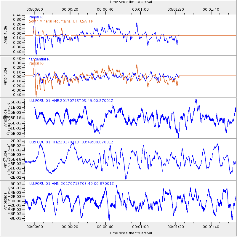
FORU South Mineral Mountains, UT, USA - Earthquake Result Viewer
*The percent match for this event was below the threshold and hence no stack was calculated.
| Earthquake location: |
New Ireland Region, P.N.G. |
| Earthquake latitude/longitude: |
-4.8/153.2 |
| Earthquake time(UTC): |
2017/07/13 (194) 03:36:09 GMT |
| Earthquake Depth: |
47 km |
| Earthquake Magnitude: |
6.4 mww |
| Earthquake Catalog/Contributor: |
NEIC PDE/us |
|
| Network: |
UU University of Utah Regional Network |
| Station: |
FORU South Mineral Mountains, UT, USA |
| Lat/Lon: |
38.46 N/112.86 W |
| Elevation: |
1840 m |
|
| Distance: |
96.1 deg |
| Az: |
51.962 deg |
| Baz: |
268.717 deg |
| Ray Param: |
$rayparam |
*The percent match for this event was below the threshold and hence was not used in the summary stack. |
|
| Radial Match: |
60.87062 % |
| Radial Bump: |
400 |
| Transverse Match: |
58.153515 % |
| Transverse Bump: |
400 |
| SOD ConfigId: |
2140511 |
| Insert Time: |
2017-07-26 19:34:16.858 +0000 |
| GWidth: |
2.5 |
| Max Bumps: |
400 |
| Tol: |
0.001 |
|
Signal To Noise
| Channel | StoN | STA | LTA |
| UU:FORU:01:HHZ:20170713T03:49:00.87001Z | 2.7676363 | 9.345506E-9 | 3.3767102E-9 |
| UU:FORU:01:HHN:20170713T03:49:00.87001Z | 0.62211716 | 1.4594905E-9 | 2.3460058E-9 |
| UU:FORU:01:HHE:20170713T03:49:00.87001Z | 1.9039627 | 7.566393E-9 | 3.9740233E-9 |
| Arrivals |
| Ps | |
| PpPs | |
| PsPs/PpSs | |


