You are here: Home > Network List > WY - Yellowstone Wyoming Seismic Network Stations List
> Station YPP Pitchstone Plateau, YNP, WY, USA > Earthquake Result Viewer
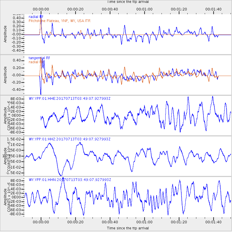
YPP Pitchstone Plateau, YNP, WY, USA - Earthquake Result Viewer
*The percent match for this event was below the threshold and hence no stack was calculated.
| Earthquake location: |
New Ireland Region, P.N.G. |
| Earthquake latitude/longitude: |
-4.8/153.2 |
| Earthquake time(UTC): |
2017/07/13 (194) 03:36:09 GMT |
| Earthquake Depth: |
47 km |
| Earthquake Magnitude: |
6.4 mww |
| Earthquake Catalog/Contributor: |
NEIC PDE/us |
|
| Network: |
WY Yellowstone Wyoming Seismic Network |
| Station: |
YPP Pitchstone Plateau, YNP, WY, USA |
| Lat/Lon: |
44.27 N/110.80 W |
| Elevation: |
2707 m |
|
| Distance: |
97.6 deg |
| Az: |
46.121 deg |
| Baz: |
270.771 deg |
| Ray Param: |
$rayparam |
*The percent match for this event was below the threshold and hence was not used in the summary stack. |
|
| Radial Match: |
70.7521 % |
| Radial Bump: |
400 |
| Transverse Match: |
69.34777 % |
| Transverse Bump: |
400 |
| SOD ConfigId: |
2140511 |
| Insert Time: |
2017-07-26 19:35:41.746 +0000 |
| GWidth: |
2.5 |
| Max Bumps: |
400 |
| Tol: |
0.001 |
|
Signal To Noise
| Channel | StoN | STA | LTA |
| WY:YPP:01:HHZ:20170713T03:49:07.927993Z | 6.066389 | 6.6623738E-9 | 1.0982438E-9 |
| WY:YPP:01:HHN:20170713T03:49:07.927993Z | 0.64709276 | 2.101979E-9 | 3.248343E-9 |
| WY:YPP:01:HHE:20170713T03:49:07.927993Z | 1.2631762 | 2.922229E-9 | 2.3133977E-9 |
| Arrivals |
| Ps | |
| PpPs | |
| PsPs/PpSs | |


