You are here: Home > Network List > CI - Caltech Regional Seismic Network Stations List
> Station SMM Simmler, CA, USA > Earthquake Result Viewer
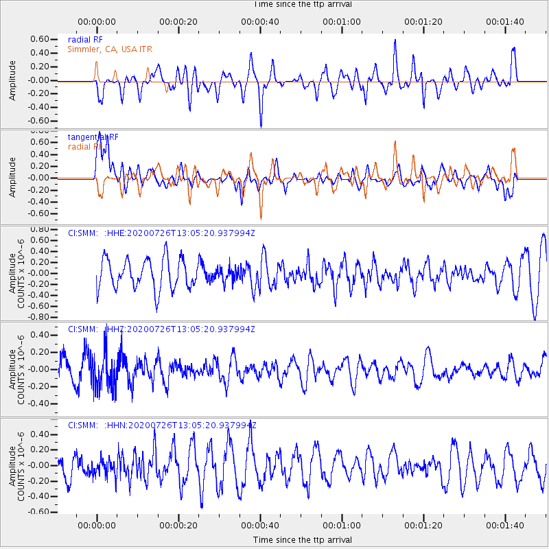
SMM Simmler, CA, USA - Earthquake Result Viewer
*The percent match for this event was below the threshold and hence no stack was calculated.
| Earthquake location: |
Taiwan Region |
| Earthquake latitude/longitude: |
24.3/122.5 |
| Earthquake time(UTC): |
2020/07/26 (208) 12:52:29 GMT |
| Earthquake Depth: |
53 km |
| Earthquake Magnitude: |
5.2 Mww |
| Earthquake Catalog/Contributor: |
NEIC PDE/us |
|
| Network: |
CI Caltech Regional Seismic Network |
| Station: |
SMM Simmler, CA, USA |
| Lat/Lon: |
35.31 N/120.00 W |
| Elevation: |
599 m |
|
| Distance: |
96.3 deg |
| Az: |
46.847 deg |
| Baz: |
305.498 deg |
| Ray Param: |
$rayparam |
*The percent match for this event was below the threshold and hence was not used in the summary stack. |
|
| Radial Match: |
74.75618 % |
| Radial Bump: |
400 |
| Transverse Match: |
45.711044 % |
| Transverse Bump: |
400 |
| SOD ConfigId: |
21709731 |
| Insert Time: |
2020-08-09 12:58:39.618 +0000 |
| GWidth: |
2.5 |
| Max Bumps: |
400 |
| Tol: |
0.001 |
|
Signal To Noise
| Channel | StoN | STA | LTA |
| CI:SMM: :HHZ:20200726T13:05:20.937994Z | 1.2497995 | 2.1531338E-7 | 1.7227833E-7 |
| CI:SMM: :HHN:20200726T13:05:20.937994Z | 0.5034141 | 1.0941145E-7 | 2.173389E-7 |
| CI:SMM: :HHE:20200726T13:05:20.937994Z | 0.4185787 | 1.1338243E-7 | 2.708748E-7 |
| Arrivals |
| Ps | |
| PpPs | |
| PsPs/PpSs | |


