You are here: Home > Network List > TA - USArray Transportable Network (new EarthScope stations) Stations List
> Station G21K Allakaket, AK, USA > Earthquake Result Viewer
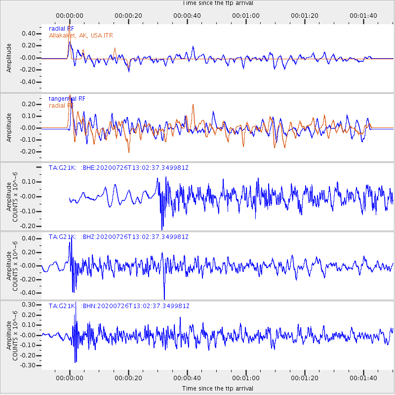
G21K Allakaket, AK, USA - Earthquake Result Viewer
*The percent match for this event was below the threshold and hence no stack was calculated.
| Earthquake location: |
Taiwan Region |
| Earthquake latitude/longitude: |
24.3/122.5 |
| Earthquake time(UTC): |
2020/07/26 (208) 12:52:29 GMT |
| Earthquake Depth: |
53 km |
| Earthquake Magnitude: |
5.2 Mww |
| Earthquake Catalog/Contributor: |
NEIC PDE/us |
|
| Network: |
TA USArray Transportable Network (new EarthScope stations) |
| Station: |
G21K Allakaket, AK, USA |
| Lat/Lon: |
66.52 N/153.51 W |
| Elevation: |
446 m |
|
| Distance: |
65.6 deg |
| Az: |
25.947 deg |
| Baz: |
274.844 deg |
| Ray Param: |
$rayparam |
*The percent match for this event was below the threshold and hence was not used in the summary stack. |
|
| Radial Match: |
48.87902 % |
| Radial Bump: |
400 |
| Transverse Match: |
56.83392 % |
| Transverse Bump: |
400 |
| SOD ConfigId: |
21709731 |
| Insert Time: |
2020-08-09 13:06:33.616 +0000 |
| GWidth: |
2.5 |
| Max Bumps: |
400 |
| Tol: |
0.001 |
|
Signal To Noise
| Channel | StoN | STA | LTA |
| TA:G21K: :BHZ:20200726T13:02:37.349981Z | 4.011651 | 1.680119E-7 | 4.1880988E-8 |
| TA:G21K: :BHN:20200726T13:02:37.349981Z | 2.547198 | 9.281102E-8 | 3.6436514E-8 |
| TA:G21K: :BHE:20200726T13:02:37.349981Z | 2.6139152 | 8.248156E-8 | 3.1554798E-8 |
| Arrivals |
| Ps | |
| PpPs | |
| PsPs/PpSs | |


