You are here: Home > Network List > TA - USArray Transportable Network (new EarthScope stations) Stations List
> Station I30M Mount Dempster, Yukon, CAN > Earthquake Result Viewer
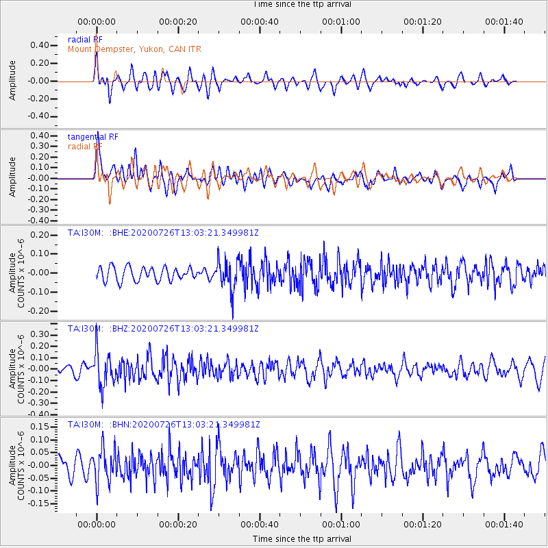
I30M Mount Dempster, Yukon, CAN - Earthquake Result Viewer
*The percent match for this event was below the threshold and hence no stack was calculated.
| Earthquake location: |
Taiwan Region |
| Earthquake latitude/longitude: |
24.3/122.5 |
| Earthquake time(UTC): |
2020/07/26 (208) 12:52:29 GMT |
| Earthquake Depth: |
53 km |
| Earthquake Magnitude: |
5.2 Mww |
| Earthquake Catalog/Contributor: |
NEIC PDE/us |
|
| Network: |
TA USArray Transportable Network (new EarthScope stations) |
| Station: |
I30M Mount Dempster, Yukon, CAN |
| Lat/Lon: |
65.22 N/136.38 W |
| Elevation: |
1399 m |
|
| Distance: |
72.8 deg |
| Az: |
25.649 deg |
| Baz: |
290.374 deg |
| Ray Param: |
$rayparam |
*The percent match for this event was below the threshold and hence was not used in the summary stack. |
|
| Radial Match: |
54.462315 % |
| Radial Bump: |
400 |
| Transverse Match: |
61.7864 % |
| Transverse Bump: |
400 |
| SOD ConfigId: |
21709731 |
| Insert Time: |
2020-08-09 13:06:57.917 +0000 |
| GWidth: |
2.5 |
| Max Bumps: |
400 |
| Tol: |
0.001 |
|
Signal To Noise
| Channel | StoN | STA | LTA |
| TA:I30M: :BHZ:20200726T13:03:21.349981Z | 3.5138397 | 1.5017176E-7 | 4.2737224E-8 |
| TA:I30M: :BHN:20200726T13:03:21.349981Z | 1.4560969 | 6.845117E-8 | 4.7010044E-8 |
| TA:I30M: :BHE:20200726T13:03:21.349981Z | 2.254805 | 7.896008E-8 | 3.501858E-8 |
| Arrivals |
| Ps | |
| PpPs | |
| PsPs/PpSs | |


