You are here: Home > Network List > TA - USArray Transportable Network (new EarthScope stations) Stations List
> Station M31M Drury Creek, Yukon, CA > Earthquake Result Viewer
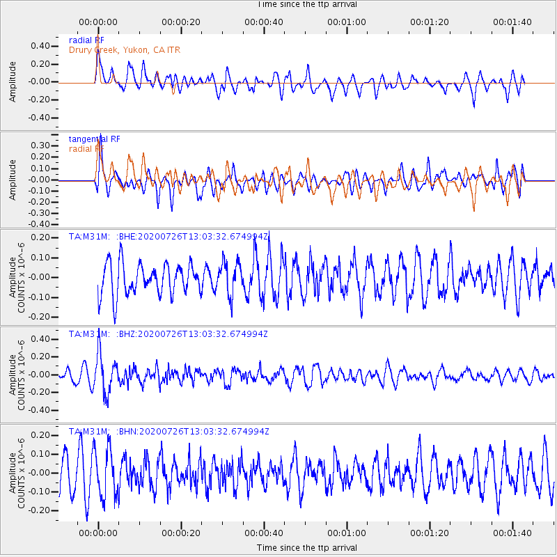
M31M Drury Creek, Yukon, CA - Earthquake Result Viewer
*The percent match for this event was below the threshold and hence no stack was calculated.
| Earthquake location: |
Taiwan Region |
| Earthquake latitude/longitude: |
24.3/122.5 |
| Earthquake time(UTC): |
2020/07/26 (208) 12:52:29 GMT |
| Earthquake Depth: |
53 km |
| Earthquake Magnitude: |
5.2 Mww |
| Earthquake Catalog/Contributor: |
NEIC PDE/us |
|
| Network: |
TA USArray Transportable Network (new EarthScope stations) |
| Station: |
M31M Drury Creek, Yukon, CA |
| Lat/Lon: |
62.20 N/134.39 W |
| Elevation: |
639 m |
|
| Distance: |
74.7 deg |
| Az: |
28.245 deg |
| Baz: |
292.88 deg |
| Ray Param: |
$rayparam |
*The percent match for this event was below the threshold and hence was not used in the summary stack. |
|
| Radial Match: |
72.52567 % |
| Radial Bump: |
400 |
| Transverse Match: |
69.220604 % |
| Transverse Bump: |
400 |
| SOD ConfigId: |
21709731 |
| Insert Time: |
2020-08-09 13:07:22.198 +0000 |
| GWidth: |
2.5 |
| Max Bumps: |
400 |
| Tol: |
0.001 |
|
Signal To Noise
| Channel | StoN | STA | LTA |
| TA:M31M: :BHZ:20200726T13:03:32.674994Z | 4.661903 | 2.1953556E-7 | 4.7091405E-8 |
| TA:M31M: :BHN:20200726T13:03:32.674994Z | 1.7973082 | 1.2501263E-7 | 6.9555476E-8 |
| TA:M31M: :BHE:20200726T13:03:32.674994Z | 1.0646892 | 8.34219E-8 | 7.8353295E-8 |
| Arrivals |
| Ps | |
| PpPs | |
| PsPs/PpSs | |


