You are here: Home > Network List > UW - Pacific Northwest Regional Seismic Network Stations List
> Station IRON Crane, OR, USA > Earthquake Result Viewer
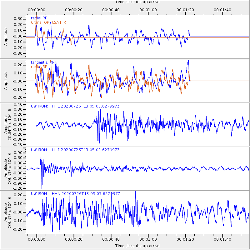
IRON Crane, OR, USA - Earthquake Result Viewer
*The percent match for this event was below the threshold and hence no stack was calculated.
| Earthquake location: |
Taiwan Region |
| Earthquake latitude/longitude: |
24.3/122.5 |
| Earthquake time(UTC): |
2020/07/26 (208) 12:52:29 GMT |
| Earthquake Depth: |
53 km |
| Earthquake Magnitude: |
5.2 Mww |
| Earthquake Catalog/Contributor: |
NEIC PDE/us |
|
| Network: |
UW Pacific Northwest Regional Seismic Network |
| Station: |
IRON Crane, OR, USA |
| Lat/Lon: |
43.36 N/118.47 W |
| Elevation: |
1226 m |
|
| Distance: |
92.5 deg |
| Az: |
39.651 deg |
| Baz: |
307.016 deg |
| Ray Param: |
$rayparam |
*The percent match for this event was below the threshold and hence was not used in the summary stack. |
|
| Radial Match: |
72.5912 % |
| Radial Bump: |
400 |
| Transverse Match: |
62.37362 % |
| Transverse Bump: |
400 |
| SOD ConfigId: |
21709731 |
| Insert Time: |
2020-08-09 13:09:17.959 +0000 |
| GWidth: |
2.5 |
| Max Bumps: |
400 |
| Tol: |
0.001 |
|
Signal To Noise
| Channel | StoN | STA | LTA |
| UW:IRON: :HHZ:20200726T13:05:03.627997Z | 6.6183066 | 3.465171E-7 | 5.2357368E-8 |
| UW:IRON: :HHN:20200726T13:05:03.627997Z | 1.1044188 | 5.9203536E-8 | 5.360606E-8 |
| UW:IRON: :HHE:20200726T13:05:03.627997Z | 4.2571077 | 1.4927589E-7 | 3.5065096E-8 |
| Arrivals |
| Ps | |
| PpPs | |
| PsPs/PpSs | |


