You are here: Home > Network List > UW - Pacific Northwest Regional Seismic Network Stations List
> Station UMAT Pilot Rock, OR, USA > Earthquake Result Viewer
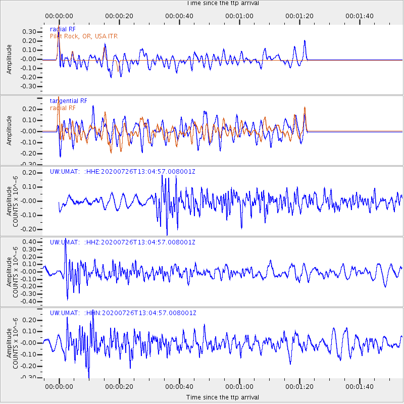
UMAT Pilot Rock, OR, USA - Earthquake Result Viewer
*The percent match for this event was below the threshold and hence no stack was calculated.
| Earthquake location: |
Taiwan Region |
| Earthquake latitude/longitude: |
24.3/122.5 |
| Earthquake time(UTC): |
2020/07/26 (208) 12:52:29 GMT |
| Earthquake Depth: |
53 km |
| Earthquake Magnitude: |
5.2 Mww |
| Earthquake Catalog/Contributor: |
NEIC PDE/us |
|
| Network: |
UW Pacific Northwest Regional Seismic Network |
| Station: |
UMAT Pilot Rock, OR, USA |
| Lat/Lon: |
45.29 N/118.96 W |
| Elevation: |
1318 m |
|
| Distance: |
91.1 deg |
| Az: |
38.314 deg |
| Baz: |
306.72 deg |
| Ray Param: |
$rayparam |
*The percent match for this event was below the threshold and hence was not used in the summary stack. |
|
| Radial Match: |
45.83543 % |
| Radial Bump: |
400 |
| Transverse Match: |
44.488846 % |
| Transverse Bump: |
400 |
| SOD ConfigId: |
21709731 |
| Insert Time: |
2020-08-09 13:10:03.720 +0000 |
| GWidth: |
2.5 |
| Max Bumps: |
400 |
| Tol: |
0.001 |
|
Signal To Noise
| Channel | StoN | STA | LTA |
| UW:UMAT: :HHZ:20200726T13:04:57.008001Z | 2.676552 | 1.5866006E-7 | 5.9277774E-8 |
| UW:UMAT: :HHN:20200726T13:04:57.008001Z | 1.5152668 | 8.2251326E-8 | 5.4281745E-8 |
| UW:UMAT: :HHE:20200726T13:04:57.008001Z | 2.467589 | 7.3246575E-8 | 2.9683461E-8 |
| Arrivals |
| Ps | |
| PpPs | |
| PsPs/PpSs | |


