You are here: Home > Network List > WY - Yellowstone Wyoming Seismic Network Stations List
> Station YHH Holmes Hill, YNP, WY, USA > Earthquake Result Viewer
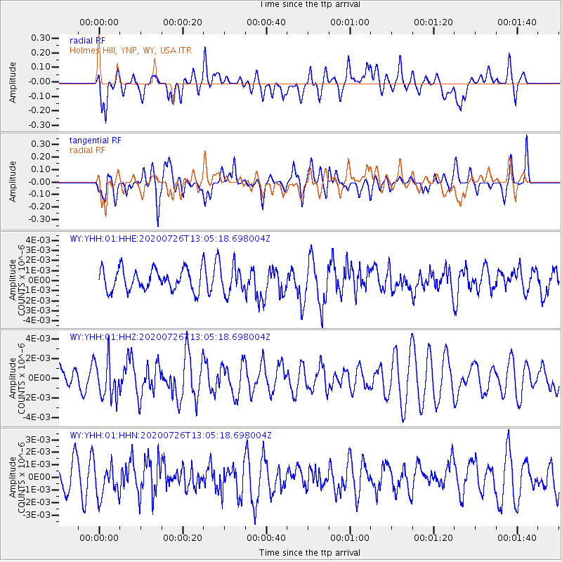
YHH Holmes Hill, YNP, WY, USA - Earthquake Result Viewer
*The percent match for this event was below the threshold and hence no stack was calculated.
| Earthquake location: |
Taiwan Region |
| Earthquake latitude/longitude: |
24.3/122.5 |
| Earthquake time(UTC): |
2020/07/26 (208) 12:52:29 GMT |
| Earthquake Depth: |
53 km |
| Earthquake Magnitude: |
5.2 Mww |
| Earthquake Catalog/Contributor: |
NEIC PDE/us |
|
| Network: |
WY Yellowstone Wyoming Seismic Network |
| Station: |
YHH Holmes Hill, YNP, WY, USA |
| Lat/Lon: |
44.79 N/110.85 W |
| Elevation: |
2717 m |
|
| Distance: |
95.8 deg |
| Az: |
35.025 deg |
| Baz: |
312.641 deg |
| Ray Param: |
$rayparam |
*The percent match for this event was below the threshold and hence was not used in the summary stack. |
|
| Radial Match: |
46.599533 % |
| Radial Bump: |
400 |
| Transverse Match: |
68.234856 % |
| Transverse Bump: |
400 |
| SOD ConfigId: |
21709731 |
| Insert Time: |
2020-08-09 13:10:19.546 +0000 |
| GWidth: |
2.5 |
| Max Bumps: |
400 |
| Tol: |
0.001 |
|
Signal To Noise
| Channel | StoN | STA | LTA |
| WY:YHH:01:HHZ:20200726T13:05:18.698004Z | 1.9508733 | 1.9101185E-9 | 9.791095E-10 |
| WY:YHH:01:HHN:20200726T13:05:18.698004Z | 1.2306551 | 1.2891329E-9 | 1.0475176E-9 |
| WY:YHH:01:HHE:20200726T13:05:18.698004Z | 1.2425722 | 1.2965613E-9 | 1.0434494E-9 |
| Arrivals |
| Ps | |
| PpPs | |
| PsPs/PpSs | |


