You are here: Home > Network List > TX - Texas Seismological Network Stations List
> Station WTFS Witchita Falls > Earthquake Result Viewer
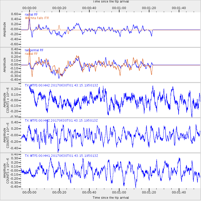
WTFS Witchita Falls - Earthquake Result Viewer
*The percent match for this event was below the threshold and hence no stack was calculated.
| Earthquake location: |
Northern Mid-Atlantic Ridge |
| Earthquake latitude/longitude: |
33.7/-38.5 |
| Earthquake time(UTC): |
2017/06/30 (181) 01:34:58 GMT |
| Earthquake Depth: |
10 km |
| Earthquake Magnitude: |
5.8 Mwb |
| Earthquake Catalog/Contributor: |
NEIC PDE/us |
|
| Network: |
TX Texas Seismological Network |
| Station: |
WTFS Witchita Falls |
| Lat/Lon: |
33.77 N/98.46 W |
| Elevation: |
277 m |
|
| Distance: |
49.2 deg |
| Az: |
287.701 deg |
| Baz: |
72.336 deg |
| Ray Param: |
$rayparam |
*The percent match for this event was below the threshold and hence was not used in the summary stack. |
|
| Radial Match: |
58.99349 % |
| Radial Bump: |
400 |
| Transverse Match: |
47.77406 % |
| Transverse Bump: |
400 |
| SOD ConfigId: |
2140511 |
| Insert Time: |
2017-07-27 23:38:41.288 +0000 |
| GWidth: |
2.5 |
| Max Bumps: |
400 |
| Tol: |
0.001 |
|
Signal To Noise
| Channel | StoN | STA | LTA |
| TX:WTFS:00:HHZ:20170630T01:43:15.195013Z | 1.803764 | 1.6091427E-7 | 8.921027E-8 |
| TX:WTFS:00:HH1:20170630T01:43:15.195013Z | 1.1200769 | 7.768198E-8 | 6.935415E-8 |
| TX:WTFS:00:HH2:20170630T01:43:15.195013Z | 1.0816257 | 1.0981031E-7 | 1.0152338E-7 |
| Arrivals |
| Ps | |
| PpPs | |
| PsPs/PpSs | |


