You are here: Home > Network List > TA - USArray Transportable Network (new EarthScope stations) Stations List
> Station F21K Alatna River, AK, USA > Earthquake Result Viewer
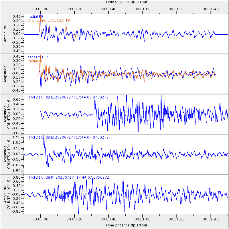
F21K Alatna River, AK, USA - Earthquake Result Viewer
*The percent match for this event was below the threshold and hence no stack was calculated.
| Earthquake location: |
Mindanao, Philippines |
| Earthquake latitude/longitude: |
9.0/126.3 |
| Earthquake time(UTC): |
2020/07/27 (209) 17:32:44 GMT |
| Earthquake Depth: |
39 km |
| Earthquake Magnitude: |
5.7 Mww |
| Earthquake Catalog/Contributor: |
NEIC PDE/us |
|
| Network: |
TA USArray Transportable Network (new EarthScope stations) |
| Station: |
F21K Alatna River, AK, USA |
| Lat/Lon: |
67.22 N/153.48 W |
| Elevation: |
597 m |
|
| Distance: |
78.0 deg |
| Az: |
23.103 deg |
| Baz: |
264.515 deg |
| Ray Param: |
$rayparam |
*The percent match for this event was below the threshold and hence was not used in the summary stack. |
|
| Radial Match: |
76.798996 % |
| Radial Bump: |
400 |
| Transverse Match: |
63.967453 % |
| Transverse Bump: |
400 |
| SOD ConfigId: |
21709731 |
| Insert Time: |
2020-08-10 17:46:34.210 +0000 |
| GWidth: |
2.5 |
| Max Bumps: |
400 |
| Tol: |
0.001 |
|
Signal To Noise
| Channel | StoN | STA | LTA |
| TA:F21K: :BHZ:20200727T17:44:07.875027Z | 8.743328 | 6.755369E-7 | 7.726313E-8 |
| TA:F21K: :BHN:20200727T17:44:07.875027Z | 2.0178175 | 1.3556408E-7 | 6.718352E-8 |
| TA:F21K: :BHE:20200727T17:44:07.875027Z | 3.5182357 | 2.485031E-7 | 7.063288E-8 |
| Arrivals |
| Ps | |
| PpPs | |
| PsPs/PpSs | |


