You are here: Home > Network List > TA - USArray Transportable Network (new EarthScope stations) Stations List
> Station POKR Poker Plat Research Range, AK, USA > Earthquake Result Viewer
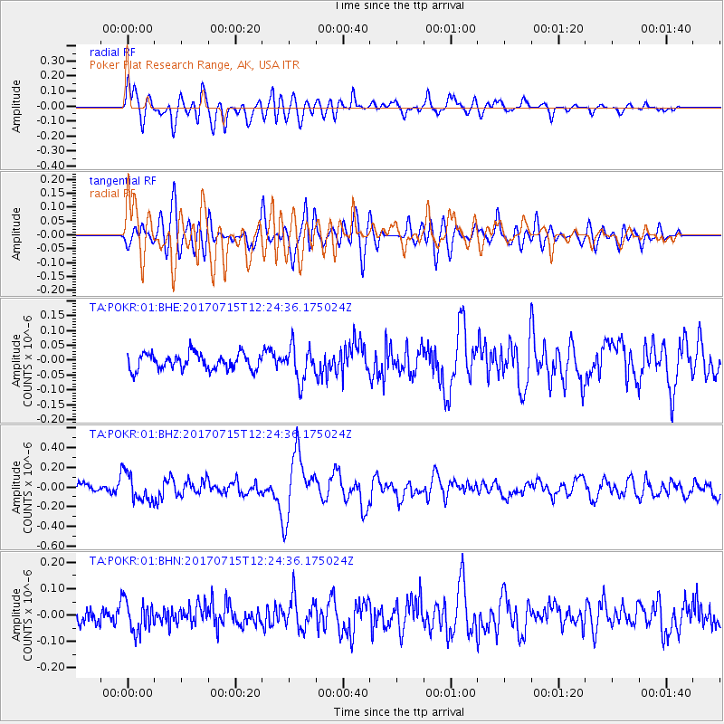
POKR Poker Plat Research Range, AK, USA - Earthquake Result Viewer
*The percent match for this event was below the threshold and hence no stack was calculated.
| Earthquake location: |
Minahassa Peninsula, Sulawesi |
| Earthquake latitude/longitude: |
0.4/122.0 |
| Earthquake time(UTC): |
2017/07/15 (196) 12:12:21 GMT |
| Earthquake Depth: |
114 km |
| Earthquake Magnitude: |
5.9 Mww |
| Earthquake Catalog/Contributor: |
NEIC PDE/us |
|
| Network: |
TA USArray Transportable Network (new EarthScope stations) |
| Station: |
POKR Poker Plat Research Range, AK, USA |
| Lat/Lon: |
65.12 N/147.43 W |
| Elevation: |
501 m |
|
| Distance: |
89.9 deg |
| Az: |
25.029 deg |
| Baz: |
270.655 deg |
| Ray Param: |
$rayparam |
*The percent match for this event was below the threshold and hence was not used in the summary stack. |
|
| Radial Match: |
68.32978 % |
| Radial Bump: |
400 |
| Transverse Match: |
60.23433 % |
| Transverse Bump: |
400 |
| SOD ConfigId: |
2140511 |
| Insert Time: |
2017-07-29 04:06:22.062 +0000 |
| GWidth: |
2.5 |
| Max Bumps: |
400 |
| Tol: |
0.001 |
|
Signal To Noise
| Channel | StoN | STA | LTA |
| TA:POKR:01:BHZ:20170715T12:24:36.175024Z | 4.1619086 | 1.402058E-7 | 3.368786E-8 |
| TA:POKR:01:BHN:20170715T12:24:36.175024Z | 1.772966 | 5.7659303E-8 | 3.252138E-8 |
| TA:POKR:01:BHE:20170715T12:24:36.175024Z | 2.1957905 | 5.8313255E-8 | 2.6556839E-8 |
| Arrivals |
| Ps | |
| PpPs | |
| PsPs/PpSs | |


