You are here: Home > Network List > AZ - ANZA Regional Network Stations List
> Station SMER AZ.SMER > Earthquake Result Viewer
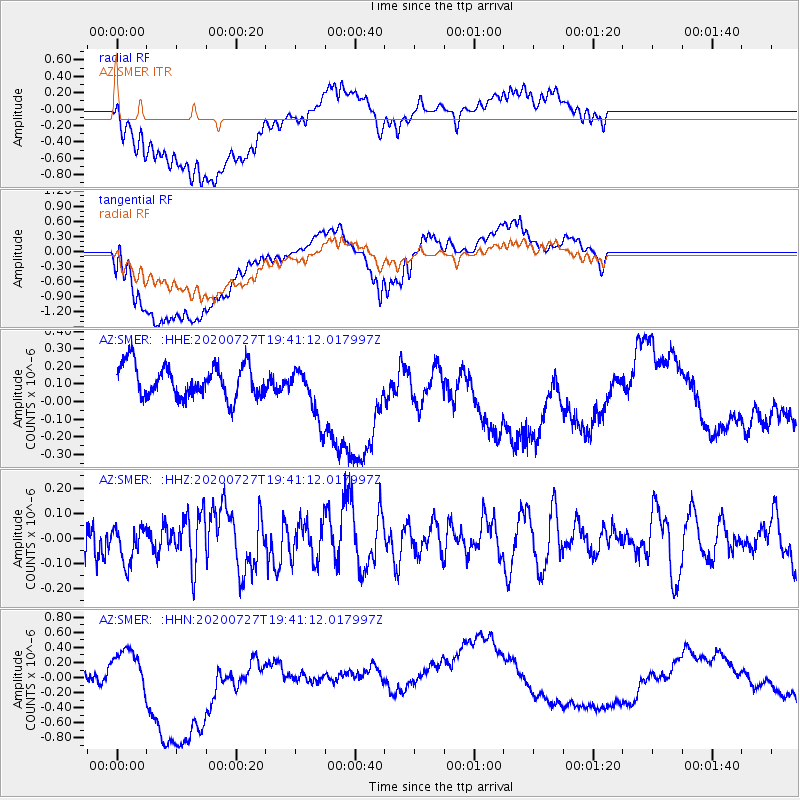
SMER AZ.SMER - Earthquake Result Viewer
*The percent match for this event was below the threshold and hence no stack was calculated.
| Earthquake location: |
Alaska Peninsula |
| Earthquake latitude/longitude: |
54.9/-160.3 |
| Earthquake time(UTC): |
2020/07/27 (209) 19:34:37 GMT |
| Earthquake Depth: |
39 km |
| Earthquake Magnitude: |
5.5 Mww |
| Earthquake Catalog/Contributor: |
NEIC PDE/us |
|
| Network: |
AZ ANZA Regional Network |
| Station: |
SMER AZ.SMER |
| Lat/Lon: |
33.46 N/117.17 W |
| Elevation: |
355 m |
|
| Distance: |
36.8 deg |
| Az: |
107.617 deg |
| Baz: |
318.833 deg |
| Ray Param: |
$rayparam |
*The percent match for this event was below the threshold and hence was not used in the summary stack. |
|
| Radial Match: |
30.203651 % |
| Radial Bump: |
400 |
| Transverse Match: |
40.74925 % |
| Transverse Bump: |
400 |
| SOD ConfigId: |
21709731 |
| Insert Time: |
2020-08-10 19:35:51.273 +0000 |
| GWidth: |
2.5 |
| Max Bumps: |
400 |
| Tol: |
0.001 |
|
Signal To Noise
| Channel | StoN | STA | LTA |
| AZ:SMER: :HHZ:20200727T19:41:12.017997Z | 0.8905546 | 7.2913956E-8 | 8.187477E-8 |
| AZ:SMER: :HHN:20200727T19:41:12.017997Z | 1.0032836 | 1.6097285E-7 | 1.6044599E-7 |
| AZ:SMER: :HHE:20200727T19:41:12.017997Z | 1.6255322 | 1.4921908E-7 | 9.179707E-8 |
| Arrivals |
| Ps | |
| PpPs | |
| PsPs/PpSs | |


