You are here: Home > Network List > CI - Caltech Regional Seismic Network Stations List
> Station MPP McPhearson Peak > Earthquake Result Viewer
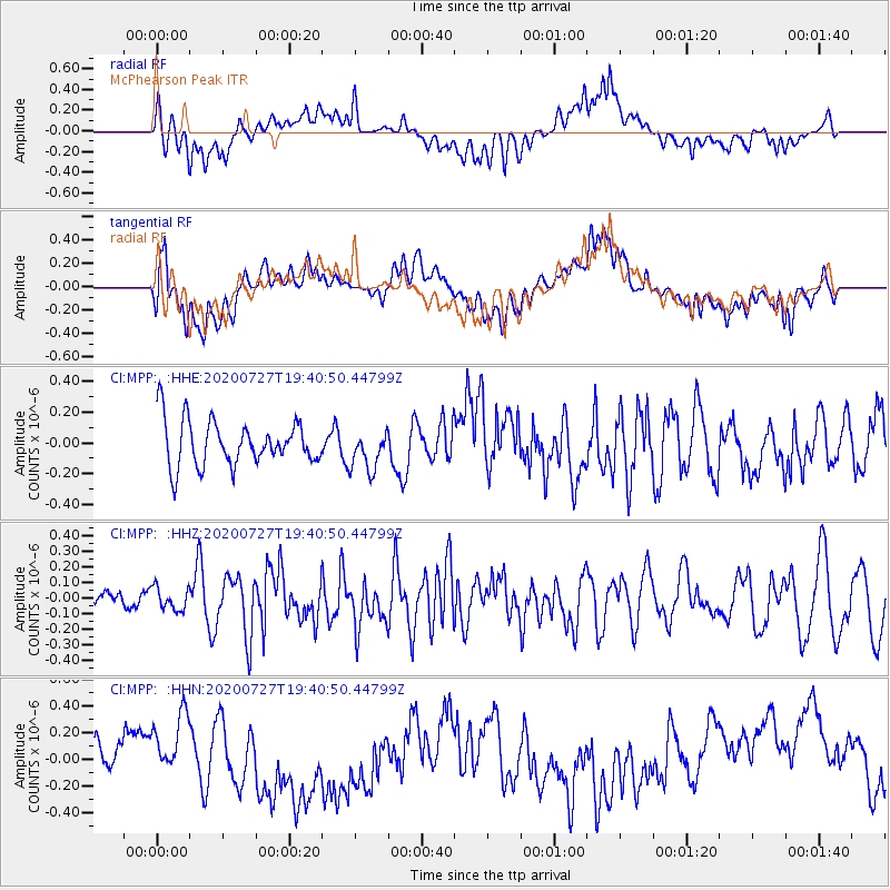
MPP McPhearson Peak - Earthquake Result Viewer
*The percent match for this event was below the threshold and hence no stack was calculated.
| Earthquake location: |
Alaska Peninsula |
| Earthquake latitude/longitude: |
54.9/-160.3 |
| Earthquake time(UTC): |
2020/07/27 (209) 19:34:37 GMT |
| Earthquake Depth: |
39 km |
| Earthquake Magnitude: |
5.5 Mww |
| Earthquake Catalog/Contributor: |
NEIC PDE/us |
|
| Network: |
CI Caltech Regional Seismic Network |
| Station: |
MPP McPhearson Peak |
| Lat/Lon: |
34.89 N/119.81 W |
| Elevation: |
1739 m |
|
| Distance: |
34.3 deg |
| Az: |
108.819 deg |
| Baz: |
318.332 deg |
| Ray Param: |
$rayparam |
*The percent match for this event was below the threshold and hence was not used in the summary stack. |
|
| Radial Match: |
58.240353 % |
| Radial Bump: |
400 |
| Transverse Match: |
63.37298 % |
| Transverse Bump: |
400 |
| SOD ConfigId: |
21709731 |
| Insert Time: |
2020-08-10 19:37:24.584 +0000 |
| GWidth: |
2.5 |
| Max Bumps: |
400 |
| Tol: |
0.001 |
|
Signal To Noise
| Channel | StoN | STA | LTA |
| CI:MPP: :HHZ:20200727T19:40:50.44799Z | 0.51845634 | 7.721824E-8 | 1.4893875E-7 |
| CI:MPP: :HHN:20200727T19:40:50.44799Z | 0.98300713 | 2.0560219E-7 | 2.0915635E-7 |
| CI:MPP: :HHE:20200727T19:40:50.44799Z | 0.8829107 | 1.290619E-7 | 1.4617774E-7 |
| Arrivals |
| Ps | |
| PpPs | |
| PsPs/PpSs | |


