You are here: Home > Network List > GS - US Geological Survey Networks Stations List
> Station OK051 E0350 and S34600 Roads, Ralston, OK > Earthquake Result Viewer
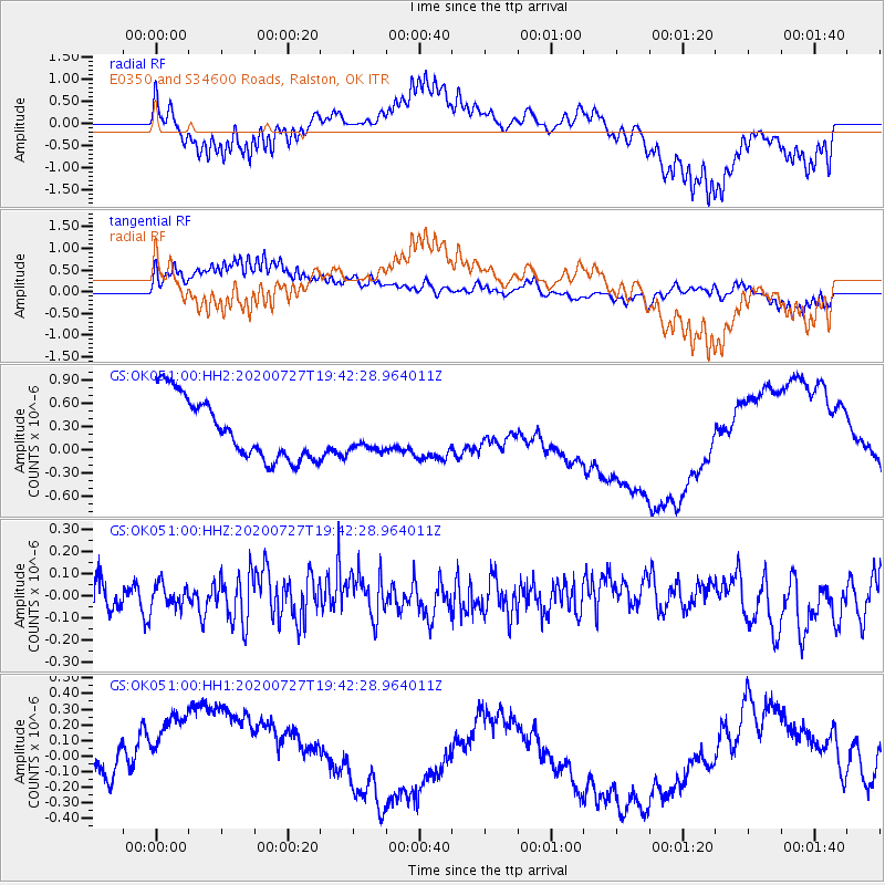
OK051 E0350 and S34600 Roads, Ralston, OK - Earthquake Result Viewer
*The percent match for this event was below the threshold and hence no stack was calculated.
| Earthquake location: |
Alaska Peninsula |
| Earthquake latitude/longitude: |
54.9/-160.3 |
| Earthquake time(UTC): |
2020/07/27 (209) 19:34:37 GMT |
| Earthquake Depth: |
39 km |
| Earthquake Magnitude: |
5.5 Mww |
| Earthquake Catalog/Contributor: |
NEIC PDE/us |
|
| Network: |
GS US Geological Survey Networks |
| Station: |
OK051 E0350 and S34600 Roads, Ralston, OK |
| Lat/Lon: |
36.51 N/96.84 W |
| Elevation: |
263 m |
|
| Distance: |
46.2 deg |
| Az: |
86.195 deg |
| Baz: |
314.354 deg |
| Ray Param: |
$rayparam |
*The percent match for this event was below the threshold and hence was not used in the summary stack. |
|
| Radial Match: |
51.090508 % |
| Radial Bump: |
325 |
| Transverse Match: |
42.393715 % |
| Transverse Bump: |
396 |
| SOD ConfigId: |
21709731 |
| Insert Time: |
2020-08-10 19:40:34.720 +0000 |
| GWidth: |
2.5 |
| Max Bumps: |
400 |
| Tol: |
0.001 |
|
Signal To Noise
| Channel | StoN | STA | LTA |
| GS:OK051:00:HHZ:20200727T19:42:28.964011Z | 0.9174702 | 5.4761884E-8 | 5.968791E-8 |
| GS:OK051:00:HH1:20200727T19:42:28.964011Z | 1.3329972 | 5.7521913E-7 | 4.3152318E-7 |
| GS:OK051:00:HH2:20200727T19:42:28.964011Z | 0.55082506 | 2.1776899E-7 | 3.9535055E-7 |
| Arrivals |
| Ps | |
| PpPs | |
| PsPs/PpSs | |


