You are here: Home > Network List > GS - US Geological Survey Networks Stations List
> Station KAN09 East Station, Caldwell, KS, USA > Earthquake Result Viewer
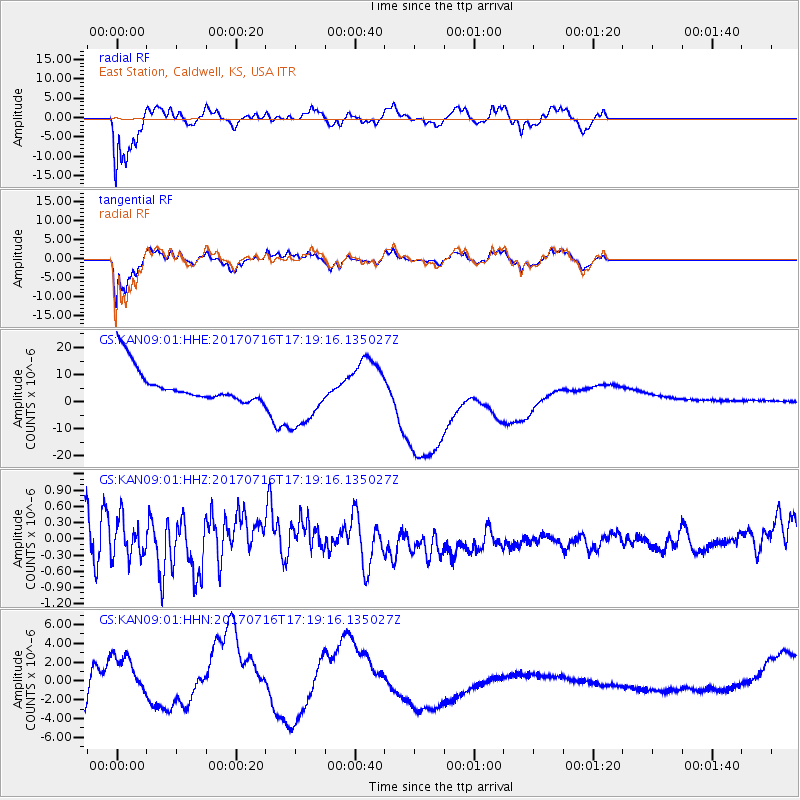
KAN09 East Station, Caldwell, KS, USA - Earthquake Result Viewer
*The percent match for this event was below the threshold and hence no stack was calculated.
| Earthquake location: |
Tonga Islands |
| Earthquake latitude/longitude: |
-20.4/-173.5 |
| Earthquake time(UTC): |
2017/07/16 (197) 17:06:41 GMT |
| Earthquake Depth: |
10 km |
| Earthquake Magnitude: |
5.5 Mww |
| Earthquake Catalog/Contributor: |
NEIC PDE/us |
|
| Network: |
GS US Geological Survey Networks |
| Station: |
KAN09 East Station, Caldwell, KS, USA |
| Lat/Lon: |
37.14 N/97.62 W |
| Elevation: |
371 m |
|
| Distance: |
91.4 deg |
| Az: |
50.814 deg |
| Baz: |
245.447 deg |
| Ray Param: |
$rayparam |
*The percent match for this event was below the threshold and hence was not used in the summary stack. |
|
| Radial Match: |
83.4273 % |
| Radial Bump: |
400 |
| Transverse Match: |
77.585556 % |
| Transverse Bump: |
400 |
| SOD ConfigId: |
2140511 |
| Insert Time: |
2017-07-30 09:02:32.411 +0000 |
| GWidth: |
2.5 |
| Max Bumps: |
400 |
| Tol: |
0.001 |
|
Signal To Noise
| Channel | StoN | STA | LTA |
| GS:KAN09:01:HHZ:20170716T17:19:16.135027Z | 1.4361873 | 3.5534515E-7 | 2.4742258E-7 |
| GS:KAN09:01:HHN:20170716T17:19:16.135027Z | 1.9978845 | 2.8812956E-6 | 1.4421732E-6 |
| GS:KAN09:01:HHE:20170716T17:19:16.135027Z | 1.9681501 | 1.2240488E-5 | 6.2192853E-6 |
| Arrivals |
| Ps | |
| PpPs | |
| PsPs/PpSs | |


