You are here: Home > Network List > US - United States National Seismic Network Stations List
> Station HDIL Hopedale, Illinois, USA > Earthquake Result Viewer
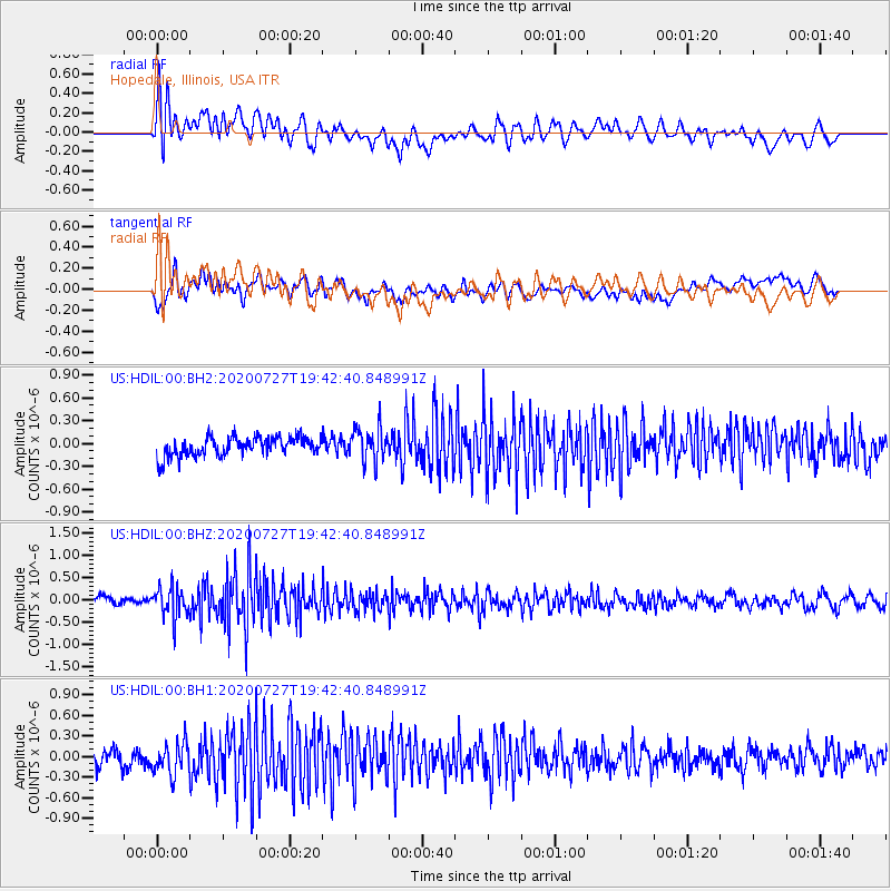
HDIL Hopedale, Illinois, USA - Earthquake Result Viewer
*The percent match for this event was below the threshold and hence no stack was calculated.
| Earthquake location: |
Alaska Peninsula |
| Earthquake latitude/longitude: |
54.9/-160.3 |
| Earthquake time(UTC): |
2020/07/27 (209) 19:34:37 GMT |
| Earthquake Depth: |
39 km |
| Earthquake Magnitude: |
5.5 Mww |
| Earthquake Catalog/Contributor: |
NEIC PDE/us |
|
| Network: |
US United States National Seismic Network |
| Station: |
HDIL Hopedale, Illinois, USA |
| Lat/Lon: |
40.56 N/89.29 W |
| Elevation: |
219 m |
|
| Distance: |
47.8 deg |
| Az: |
76.622 deg |
| Baz: |
312.504 deg |
| Ray Param: |
$rayparam |
*The percent match for this event was below the threshold and hence was not used in the summary stack. |
|
| Radial Match: |
68.95773 % |
| Radial Bump: |
400 |
| Transverse Match: |
59.46495 % |
| Transverse Bump: |
400 |
| SOD ConfigId: |
21709731 |
| Insert Time: |
2020-08-10 19:51:02.775 +0000 |
| GWidth: |
2.5 |
| Max Bumps: |
400 |
| Tol: |
0.001 |
|
Signal To Noise
| Channel | StoN | STA | LTA |
| US:HDIL:00:BHZ:20200727T19:42:40.848991Z | 4.2223477 | 3.3420113E-7 | 7.9150546E-8 |
| US:HDIL:00:BH1:20200727T19:42:40.848991Z | 2.249444 | 2.3591518E-7 | 1.0487711E-7 |
| US:HDIL:00:BH2:20200727T19:42:40.848991Z | 1.832596 | 2.2822779E-7 | 1.2453798E-7 |
| Arrivals |
| Ps | |
| PpPs | |
| PsPs/PpSs | |


