You are here: Home > Network List > TJ - Tajikistan National Seismic Network Stations List
> Station GARM Garm, Tajikistan > Earthquake Result Viewer
GARM Garm, Tajikistan - Earthquake Result Viewer
*The percent match for this event was below the threshold and hence no stack was calculated.
| Earthquake location: |
Alaska Peninsula |
| Earthquake latitude/longitude: |
55.0/-160.3 |
| Earthquake time(UTC): |
2020/07/29 (211) 09:12:17 GMT |
| Earthquake Depth: |
60 km |
| Earthquake Magnitude: |
5.5 Mi |
| Earthquake Catalog/Contributor: |
NEIC PDE/at |
|
| Network: |
TJ Tajikistan National Seismic Network |
| Station: |
GARM Garm, Tajikistan |
| Lat/Lon: |
39.00 N/70.32 E |
| Elevation: |
1305 m |
|
| Distance: |
76.8 deg |
| Az: |
321.774 deg |
| Baz: |
27.225 deg |
| Ray Param: |
$rayparam |
*The percent match for this event was below the threshold and hence was not used in the summary stack. |
|
| Radial Match: |
45.98608 % |
| Radial Bump: |
400 |
| Transverse Match: |
45.48666 % |
| Transverse Bump: |
400 |
| SOD ConfigId: |
21709731 |
| Insert Time: |
2020-08-12 09:29:12.774 +0000 |
| GWidth: |
2.5 |
| Max Bumps: |
400 |
| Tol: |
0.001 |
|
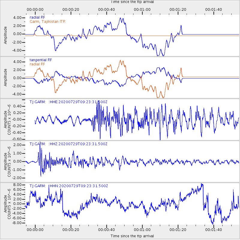
Signal To Noise
| Channel | StoN | STA | LTA |
| TJ:GARM: :HHZ:20200729T09:23:31.500Z | 10.309525 | 8.397884E-7 | 8.145753E-8 |
| TJ:GARM: :HHN:20200729T09:23:31.500Z | 1.5117242 | 3.3689648E-6 | 2.2285578E-6 |
| TJ:GARM: :HHE:20200729T09:23:31.500Z | 1.8916479 | 1.4539431E-7 | 7.686119E-8 |
| Arrivals |
| Ps | |
| PpPs | |
| PsPs/PpSs | |


