You are here: Home > Network List > US - United States National Seismic Network Stations List
> Station AGMN Agassiz National Wildlife Refuge, Minnesota, USA > Earthquake Result Viewer
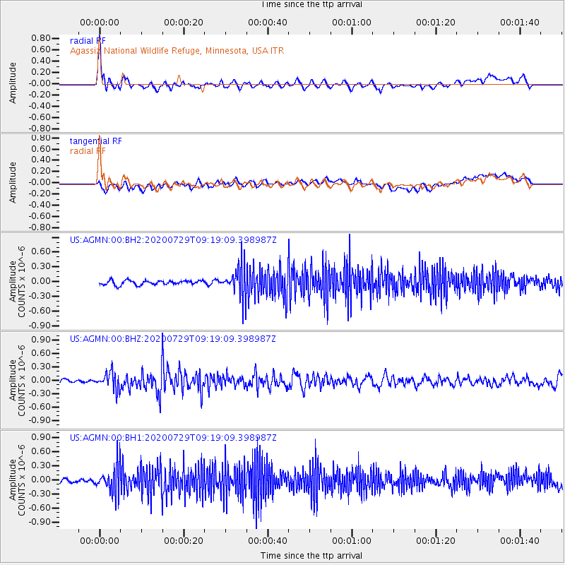
AGMN Agassiz National Wildlife Refuge, Minnesota, USA - Earthquake Result Viewer
*The percent match for this event was below the threshold and hence no stack was calculated.
| Earthquake location: |
Alaska Peninsula |
| Earthquake latitude/longitude: |
55.0/-160.3 |
| Earthquake time(UTC): |
2020/07/29 (211) 09:12:17 GMT |
| Earthquake Depth: |
60 km |
| Earthquake Magnitude: |
5.5 Mi |
| Earthquake Catalog/Contributor: |
NEIC PDE/at |
|
| Network: |
US United States National Seismic Network |
| Station: |
AGMN Agassiz National Wildlife Refuge, Minnesota, USA |
| Lat/Lon: |
48.30 N/95.86 W |
| Elevation: |
351 m |
|
| Distance: |
39.3 deg |
| Az: |
72.188 deg |
| Baz: |
304.775 deg |
| Ray Param: |
$rayparam |
*The percent match for this event was below the threshold and hence was not used in the summary stack. |
|
| Radial Match: |
63.81926 % |
| Radial Bump: |
400 |
| Transverse Match: |
45.36723 % |
| Transverse Bump: |
400 |
| SOD ConfigId: |
21709731 |
| Insert Time: |
2020-08-12 09:30:13.673 +0000 |
| GWidth: |
2.5 |
| Max Bumps: |
400 |
| Tol: |
0.001 |
|
Signal To Noise
| Channel | StoN | STA | LTA |
| US:AGMN:00:BHZ:20200729T09:19:09.398987Z | 4.1982694 | 1.9581003E-7 | 4.6640658E-8 |
| US:AGMN:00:BH1:20200729T09:19:09.398987Z | 6.2259455 | 2.8514702E-7 | 4.5799794E-8 |
| US:AGMN:00:BH2:20200729T09:19:09.398987Z | 6.827776 | 3.0454817E-7 | 4.46043E-8 |
| Arrivals |
| Ps | |
| PpPs | |
| PsPs/PpSs | |


