You are here: Home > Network List > US - United States National Seismic Network Stations List
> Station DGMT Dagmar, Montana, USA > Earthquake Result Viewer
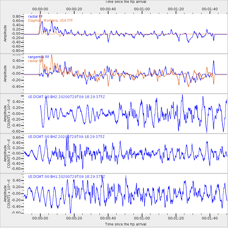
DGMT Dagmar, Montana, USA - Earthquake Result Viewer
*The percent match for this event was below the threshold and hence no stack was calculated.
| Earthquake location: |
Alaska Peninsula |
| Earthquake latitude/longitude: |
55.0/-160.3 |
| Earthquake time(UTC): |
2020/07/29 (211) 09:12:17 GMT |
| Earthquake Depth: |
60 km |
| Earthquake Magnitude: |
5.5 Mi |
| Earthquake Catalog/Contributor: |
NEIC PDE/at |
|
| Network: |
US United States National Seismic Network |
| Station: |
DGMT Dagmar, Montana, USA |
| Lat/Lon: |
48.47 N/104.20 W |
| Elevation: |
0.0 m |
|
| Distance: |
34.5 deg |
| Az: |
77.069 deg |
| Baz: |
302.466 deg |
| Ray Param: |
$rayparam |
*The percent match for this event was below the threshold and hence was not used in the summary stack. |
|
| Radial Match: |
55.213642 % |
| Radial Bump: |
400 |
| Transverse Match: |
50.90216 % |
| Transverse Bump: |
400 |
| SOD ConfigId: |
21709731 |
| Insert Time: |
2020-08-12 09:30:20.151 +0000 |
| GWidth: |
2.5 |
| Max Bumps: |
400 |
| Tol: |
0.001 |
|
Signal To Noise
| Channel | StoN | STA | LTA |
| US:DGMT:00:BHZ:20200729T09:18:29.375Z | 3.4203224 | 2.6080647E-7 | 7.625201E-8 |
| US:DGMT:00:BH1:20200729T09:18:29.375Z | 1.5052922 | 1.9625088E-7 | 1.3037395E-7 |
| US:DGMT:00:BH2:20200729T09:18:29.375Z | 0.9573939 | 1.7996108E-7 | 1.8796973E-7 |
| Arrivals |
| Ps | |
| PpPs | |
| PsPs/PpSs | |


