You are here: Home > Network List > TA - USArray Transportable Network (new EarthScope stations) Stations List
> Station E20K Nigu River, AK, USA > Earthquake Result Viewer
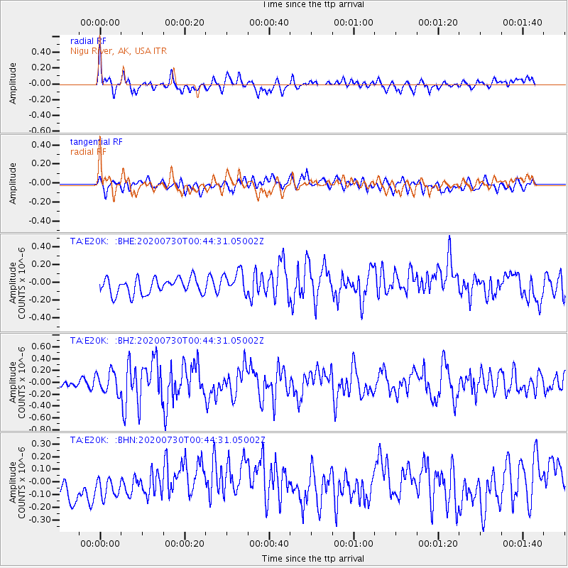
E20K Nigu River, AK, USA - Earthquake Result Viewer
*The percent match for this event was below the threshold and hence no stack was calculated.
| Earthquake location: |
Southeast Of Honshu, Japan |
| Earthquake latitude/longitude: |
30.6/141.9 |
| Earthquake time(UTC): |
2020/07/30 (212) 00:35:55 GMT |
| Earthquake Depth: |
9.5 km |
| Earthquake Magnitude: |
5.8 Mww |
| Earthquake Catalog/Contributor: |
NEIC PDE/us |
|
| Network: |
TA USArray Transportable Network (new EarthScope stations) |
| Station: |
E20K Nigu River, AK, USA |
| Lat/Lon: |
68.26 N/156.19 W |
| Elevation: |
866 m |
|
| Distance: |
51.6 deg |
| Az: |
24.82 deg |
| Baz: |
256.177 deg |
| Ray Param: |
$rayparam |
*The percent match for this event was below the threshold and hence was not used in the summary stack. |
|
| Radial Match: |
69.18973 % |
| Radial Bump: |
400 |
| Transverse Match: |
38.79041 % |
| Transverse Bump: |
400 |
| SOD ConfigId: |
21709731 |
| Insert Time: |
2020-08-13 00:53:19.214 +0000 |
| GWidth: |
2.5 |
| Max Bumps: |
400 |
| Tol: |
0.001 |
|
Signal To Noise
| Channel | StoN | STA | LTA |
| TA:E20K: :BHZ:20200730T00:44:31.05002Z | 3.7211008 | 1.7844273E-7 | 4.7954288E-8 |
| TA:E20K: :BHN:20200730T00:44:31.05002Z | 0.9991005 | 9.154523E-8 | 9.1627655E-8 |
| TA:E20K: :BHE:20200730T00:44:31.05002Z | 1.465631 | 1.3042313E-7 | 8.8987704E-8 |
| Arrivals |
| Ps | |
| PpPs | |
| PsPs/PpSs | |


