You are here: Home > Network List > TA - USArray Transportable Network (new EarthScope stations) Stations List
> Station G31M Satah River, YT, CAN > Earthquake Result Viewer
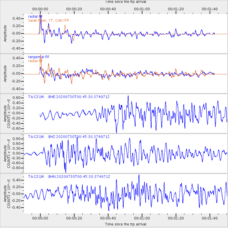
G31M Satah River, YT, CAN - Earthquake Result Viewer
*The percent match for this event was below the threshold and hence no stack was calculated.
| Earthquake location: |
Southeast Of Honshu, Japan |
| Earthquake latitude/longitude: |
30.6/141.9 |
| Earthquake time(UTC): |
2020/07/30 (212) 00:35:55 GMT |
| Earthquake Depth: |
9.5 km |
| Earthquake Magnitude: |
5.8 Mww |
| Earthquake Catalog/Contributor: |
NEIC PDE/us |
|
| Network: |
TA USArray Transportable Network (new EarthScope stations) |
| Station: |
G31M Satah River, YT, CAN |
| Lat/Lon: |
66.92 N/134.27 W |
| Elevation: |
61 m |
|
| Distance: |
59.8 deg |
| Az: |
26.955 deg |
| Baz: |
277.663 deg |
| Ray Param: |
$rayparam |
*The percent match for this event was below the threshold and hence was not used in the summary stack. |
|
| Radial Match: |
76.4565 % |
| Radial Bump: |
400 |
| Transverse Match: |
55.77831 % |
| Transverse Bump: |
400 |
| SOD ConfigId: |
21709731 |
| Insert Time: |
2020-08-13 00:53:55.931 +0000 |
| GWidth: |
2.5 |
| Max Bumps: |
400 |
| Tol: |
0.001 |
|
Signal To Noise
| Channel | StoN | STA | LTA |
| TA:G31M: :BHZ:20200730T00:45:30.374971Z | 5.014322 | 2.5273084E-7 | 5.04018E-8 |
| TA:G31M: :BHN:20200730T00:45:30.374971Z | 1.2409263 | 1.0975571E-7 | 8.8446605E-8 |
| TA:G31M: :BHE:20200730T00:45:30.374971Z | 1.510534 | 1.3381555E-7 | 8.858824E-8 |
| Arrivals |
| Ps | |
| PpPs | |
| PsPs/PpSs | |


