You are here: Home > Network List > US - United States National Seismic Network Stations List
> Station MIAR Mount Ida, Arkansas, USA > Earthquake Result Viewer
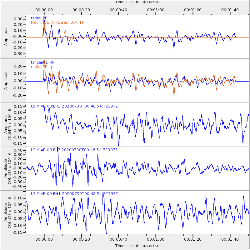
MIAR Mount Ida, Arkansas, USA - Earthquake Result Viewer
*The percent match for this event was below the threshold and hence no stack was calculated.
| Earthquake location: |
Southeast Of Honshu, Japan |
| Earthquake latitude/longitude: |
30.6/141.9 |
| Earthquake time(UTC): |
2020/07/30 (212) 00:35:55 GMT |
| Earthquake Depth: |
9.5 km |
| Earthquake Magnitude: |
5.8 Mww |
| Earthquake Catalog/Contributor: |
NEIC PDE/us |
|
| Network: |
US United States National Seismic Network |
| Station: |
MIAR Mount Ida, Arkansas, USA |
| Lat/Lon: |
34.55 N/93.58 W |
| Elevation: |
207 m |
|
| Distance: |
96.7 deg |
| Az: |
43.195 deg |
| Baz: |
314.38 deg |
| Ray Param: |
$rayparam |
*The percent match for this event was below the threshold and hence was not used in the summary stack. |
|
| Radial Match: |
65.84858 % |
| Radial Bump: |
400 |
| Transverse Match: |
56.140743 % |
| Transverse Bump: |
400 |
| SOD ConfigId: |
21709731 |
| Insert Time: |
2020-08-13 00:56:37.440 +0000 |
| GWidth: |
2.5 |
| Max Bumps: |
400 |
| Tol: |
0.001 |
|
Signal To Noise
| Channel | StoN | STA | LTA |
| US:MIAR:00:BHZ:20200730T00:48:54.72397Z | 1.8369814 | 9.033009E-8 | 4.917311E-8 |
| US:MIAR:00:BH1:20200730T00:48:54.72397Z | 1.5361724 | 4.0422158E-8 | 2.6313556E-8 |
| US:MIAR:00:BH2:20200730T00:48:54.72397Z | 1.2636706 | 5.8691374E-8 | 4.6445155E-8 |
| Arrivals |
| Ps | |
| PpPs | |
| PsPs/PpSs | |


