You are here: Home > Network List > IU - Global Seismograph Network (GSN - IRIS/USGS) Stations List
> Station JOHN Johnston Island, USA > Earthquake Result Viewer
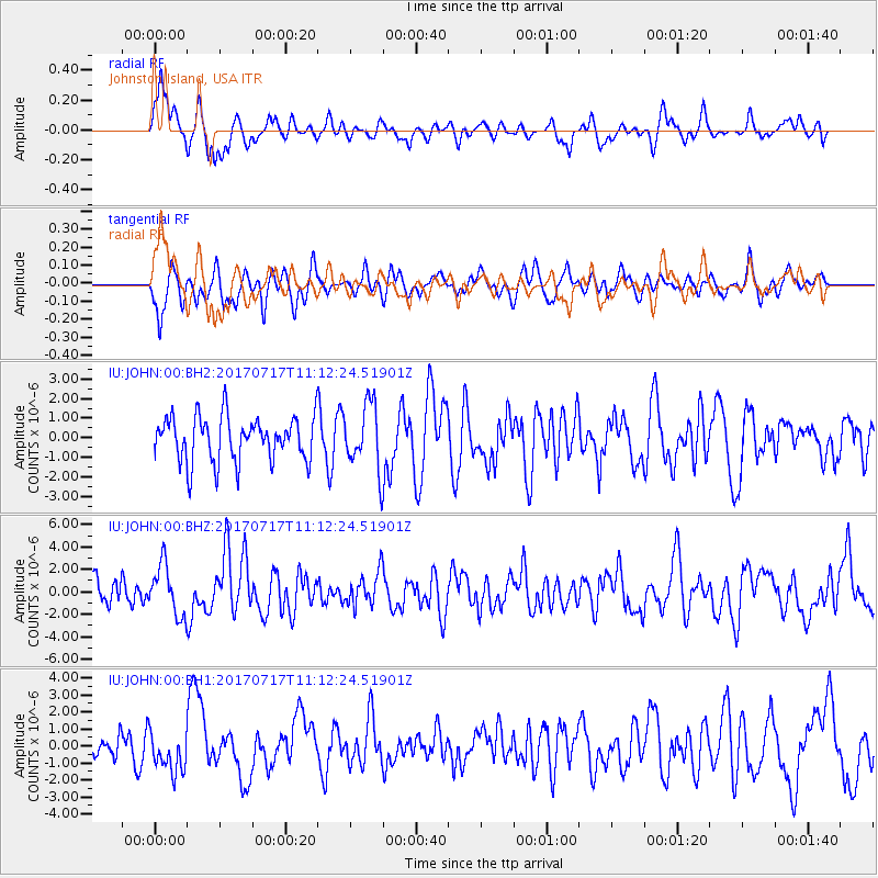
JOHN Johnston Island, USA - Earthquake Result Viewer
*The percent match for this event was below the threshold and hence no stack was calculated.
| Earthquake location: |
Komandorskiye Ostrova Region |
| Earthquake latitude/longitude: |
54.6/168.6 |
| Earthquake time(UTC): |
2017/07/17 (198) 11:05:08 GMT |
| Earthquake Depth: |
7.9 km |
| Earthquake Magnitude: |
6.2 Mww |
| Earthquake Catalog/Contributor: |
NEIC PDE/us |
|
| Network: |
IU Global Seismograph Network (GSN - IRIS/USGS) |
| Station: |
JOHN Johnston Island, USA |
| Lat/Lon: |
16.73 N/169.53 W |
| Elevation: |
2.0 m |
|
| Distance: |
41.4 deg |
| Az: |
147.386 deg |
| Baz: |
340.886 deg |
| Ray Param: |
$rayparam |
*The percent match for this event was below the threshold and hence was not used in the summary stack. |
|
| Radial Match: |
63.12554 % |
| Radial Bump: |
400 |
| Transverse Match: |
51.11215 % |
| Transverse Bump: |
400 |
| SOD ConfigId: |
2140511 |
| Insert Time: |
2017-07-31 03:00:48.708 +0000 |
| GWidth: |
2.5 |
| Max Bumps: |
400 |
| Tol: |
0.001 |
|
Signal To Noise
| Channel | StoN | STA | LTA |
| IU:JOHN:00:BHZ:20170717T11:12:24.51901Z | 1.7386818 | 2.2101715E-6 | 1.2711764E-6 |
| IU:JOHN:00:BH1:20170717T11:12:24.51901Z | 1.3850533 | 1.1685646E-6 | 8.436965E-7 |
| IU:JOHN:00:BH2:20170717T11:12:24.51901Z | 1.4687595 | 1.6781789E-6 | 1.1425825E-6 |
| Arrivals |
| Ps | |
| PpPs | |
| PsPs/PpSs | |


