You are here: Home > Network List > TX - Texas Seismological Network Stations List
> Station WTFS Witchita Falls > Earthquake Result Viewer
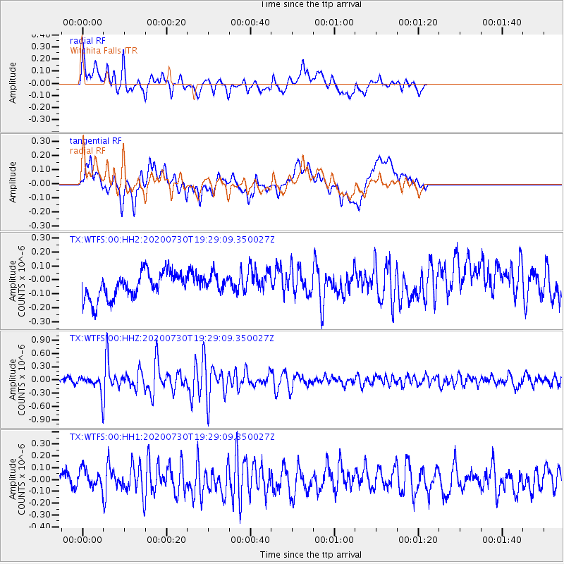
WTFS Witchita Falls - Earthquake Result Viewer
*The percent match for this event was below the threshold and hence no stack was calculated.
| Earthquake location: |
Tonga Islands |
| Earthquake latitude/longitude: |
-18.9/-173.4 |
| Earthquake time(UTC): |
2020/07/30 (212) 19:16:48 GMT |
| Earthquake Depth: |
10 km |
| Earthquake Magnitude: |
5.6 Mww |
| Earthquake Catalog/Contributor: |
NEIC PDE/us |
|
| Network: |
TX Texas Seismological Network |
| Station: |
WTFS Witchita Falls |
| Lat/Lon: |
33.77 N/98.46 W |
| Elevation: |
277 m |
|
| Distance: |
88.4 deg |
| Az: |
53.566 deg |
| Baz: |
246.105 deg |
| Ray Param: |
$rayparam |
*The percent match for this event was below the threshold and hence was not used in the summary stack. |
|
| Radial Match: |
67.16884 % |
| Radial Bump: |
400 |
| Transverse Match: |
50.603264 % |
| Transverse Bump: |
400 |
| SOD ConfigId: |
21709731 |
| Insert Time: |
2020-08-13 19:36:09.303 +0000 |
| GWidth: |
2.5 |
| Max Bumps: |
400 |
| Tol: |
0.001 |
|
Signal To Noise
| Channel | StoN | STA | LTA |
| TX:WTFS:00:HHZ:20200730T19:29:09.350027Z | 2.8672383 | 1.745539E-7 | 6.0878754E-8 |
| TX:WTFS:00:HH1:20200730T19:29:09.350027Z | 1.088026 | 8.800308E-8 | 8.088325E-8 |
| TX:WTFS:00:HH2:20200730T19:29:09.350027Z | 0.6899353 | 6.529654E-8 | 9.464154E-8 |
| Arrivals |
| Ps | |
| PpPs | |
| PsPs/PpSs | |


