You are here: Home > Network List > US - United States National Seismic Network Stations List
> Station HAWA Hanford, Washington, USA > Earthquake Result Viewer
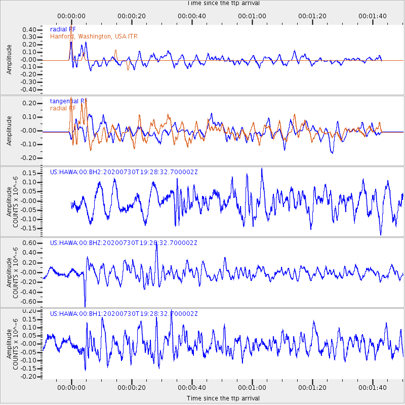
HAWA Hanford, Washington, USA - Earthquake Result Viewer
*The percent match for this event was below the threshold and hence no stack was calculated.
| Earthquake location: |
Tonga Islands |
| Earthquake latitude/longitude: |
-18.9/-173.4 |
| Earthquake time(UTC): |
2020/07/30 (212) 19:16:48 GMT |
| Earthquake Depth: |
10 km |
| Earthquake Magnitude: |
5.6 Mww |
| Earthquake Catalog/Contributor: |
NEIC PDE/us |
|
| Network: |
US United States National Seismic Network |
| Station: |
HAWA Hanford, Washington, USA |
| Lat/Lon: |
46.39 N/119.53 W |
| Elevation: |
364 m |
|
| Distance: |
81.1 deg |
| Az: |
34.435 deg |
| Baz: |
230.661 deg |
| Ray Param: |
$rayparam |
*The percent match for this event was below the threshold and hence was not used in the summary stack. |
|
| Radial Match: |
67.30109 % |
| Radial Bump: |
400 |
| Transverse Match: |
61.281155 % |
| Transverse Bump: |
400 |
| SOD ConfigId: |
21709731 |
| Insert Time: |
2020-08-13 19:36:52.850 +0000 |
| GWidth: |
2.5 |
| Max Bumps: |
400 |
| Tol: |
0.001 |
|
Signal To Noise
| Channel | StoN | STA | LTA |
| US:HAWA:00:BHZ:20200730T19:28:32.700002Z | 2.6461403 | 1.8071395E-7 | 6.829342E-8 |
| US:HAWA:00:BH1:20200730T19:28:32.700002Z | 1.2529874 | 5.056639E-8 | 4.035666E-8 |
| US:HAWA:00:BH2:20200730T19:28:32.700002Z | 0.8692708 | 4.898038E-8 | 5.6346515E-8 |
| Arrivals |
| Ps | |
| PpPs | |
| PsPs/PpSs | |


