You are here: Home > Network List > UW - Pacific Northwest Regional Seismic Network Stations List
> Station FISH Seaside, OR, USA > Earthquake Result Viewer
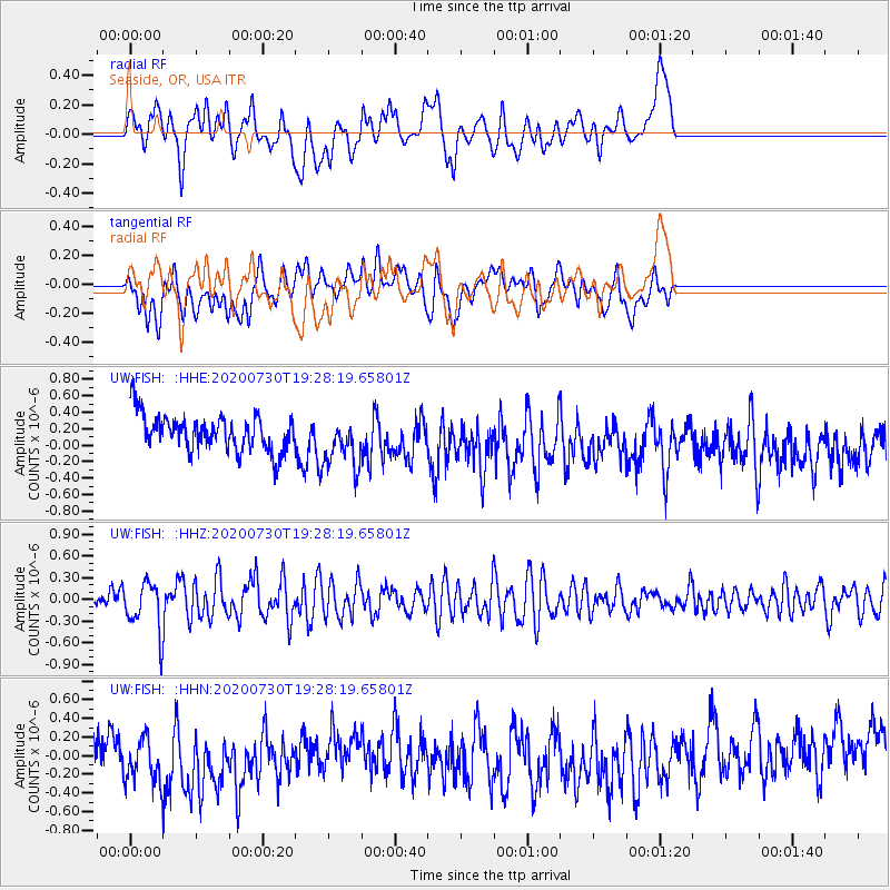
FISH Seaside, OR, USA - Earthquake Result Viewer
*The percent match for this event was below the threshold and hence no stack was calculated.
| Earthquake location: |
Tonga Islands |
| Earthquake latitude/longitude: |
-18.9/-173.4 |
| Earthquake time(UTC): |
2020/07/30 (212) 19:16:48 GMT |
| Earthquake Depth: |
10 km |
| Earthquake Magnitude: |
5.6 Mww |
| Earthquake Catalog/Contributor: |
NEIC PDE/us |
|
| Network: |
UW Pacific Northwest Regional Seismic Network |
| Station: |
FISH Seaside, OR, USA |
| Lat/Lon: |
45.93 N/123.56 W |
| Elevation: |
325 m |
|
| Distance: |
78.7 deg |
| Az: |
32.927 deg |
| Baz: |
227.502 deg |
| Ray Param: |
$rayparam |
*The percent match for this event was below the threshold and hence was not used in the summary stack. |
|
| Radial Match: |
39.648598 % |
| Radial Bump: |
400 |
| Transverse Match: |
37.382404 % |
| Transverse Bump: |
400 |
| SOD ConfigId: |
21709731 |
| Insert Time: |
2020-08-13 19:38:00.281 +0000 |
| GWidth: |
2.5 |
| Max Bumps: |
400 |
| Tol: |
0.001 |
|
Signal To Noise
| Channel | StoN | STA | LTA |
| UW:FISH: :HHZ:20200730T19:28:19.65801Z | 1.9927028 | 3.3108472E-7 | 1.6614857E-7 |
| UW:FISH: :HHN:20200730T19:28:19.65801Z | 0.8494062 | 2.6882466E-7 | 3.1648543E-7 |
| UW:FISH: :HHE:20200730T19:28:19.65801Z | 1.4274759 | 3.1466882E-7 | 2.2043722E-7 |
| Arrivals |
| Ps | |
| PpPs | |
| PsPs/PpSs | |


