You are here: Home > Network List > UW - Pacific Northwest Regional Seismic Network Stations List
> Station UMAT Pilot Rock, OR, USA > Earthquake Result Viewer
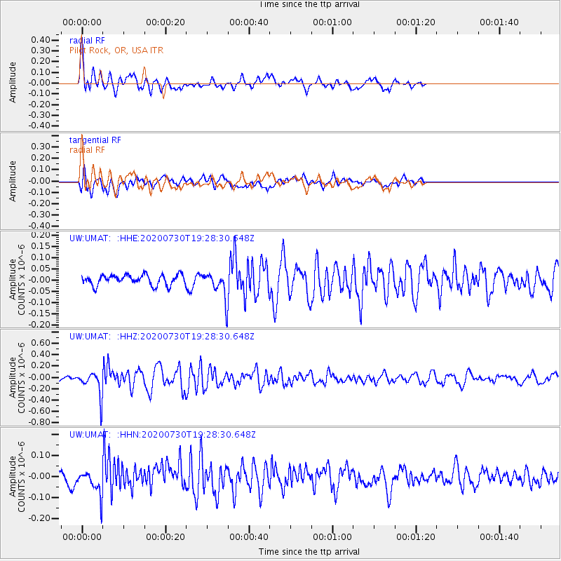
UMAT Pilot Rock, OR, USA - Earthquake Result Viewer
*The percent match for this event was below the threshold and hence no stack was calculated.
| Earthquake location: |
Tonga Islands |
| Earthquake latitude/longitude: |
-18.9/-173.4 |
| Earthquake time(UTC): |
2020/07/30 (212) 19:16:48 GMT |
| Earthquake Depth: |
10 km |
| Earthquake Magnitude: |
5.6 Mww |
| Earthquake Catalog/Contributor: |
NEIC PDE/us |
|
| Network: |
UW Pacific Northwest Regional Seismic Network |
| Station: |
UMAT Pilot Rock, OR, USA |
| Lat/Lon: |
45.29 N/118.96 W |
| Elevation: |
1318 m |
|
| Distance: |
80.7 deg |
| Az: |
35.557 deg |
| Baz: |
231.248 deg |
| Ray Param: |
$rayparam |
*The percent match for this event was below the threshold and hence was not used in the summary stack. |
|
| Radial Match: |
78.17552 % |
| Radial Bump: |
400 |
| Transverse Match: |
63.210007 % |
| Transverse Bump: |
400 |
| SOD ConfigId: |
21709731 |
| Insert Time: |
2020-08-13 19:38:41.226 +0000 |
| GWidth: |
2.5 |
| Max Bumps: |
400 |
| Tol: |
0.001 |
|
Signal To Noise
| Channel | StoN | STA | LTA |
| UW:UMAT: :HHZ:20200730T19:28:30.648Z | 4.6165886 | 2.2041804E-7 | 4.7744788E-8 |
| UW:UMAT: :HHN:20200730T19:28:30.648Z | 1.4191349 | 5.874346E-8 | 4.1393854E-8 |
| UW:UMAT: :HHE:20200730T19:28:30.648Z | 2.5858977 | 5.967304E-8 | 2.3076336E-8 |
| Arrivals |
| Ps | |
| PpPs | |
| PsPs/PpSs | |


