You are here: Home > Network List > TA - USArray Transportable Network (new EarthScope stations) Stations List
> Station M31M Drury Creek, Yukon, CA > Earthquake Result Viewer
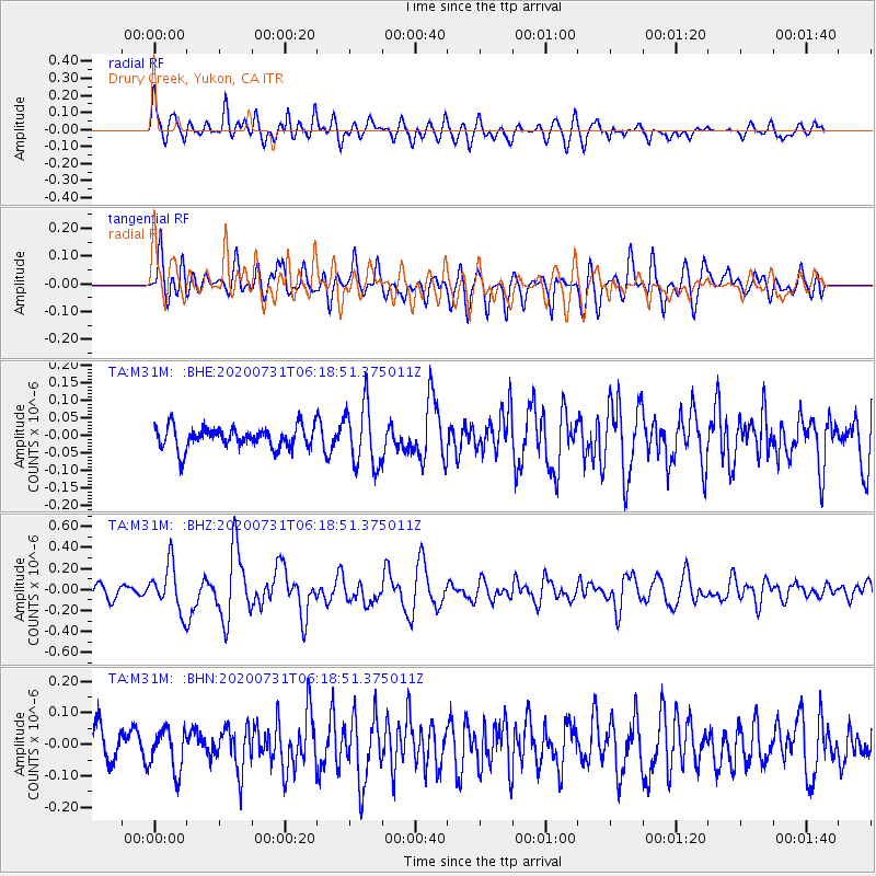
M31M Drury Creek, Yukon, CA - Earthquake Result Viewer
*The percent match for this event was below the threshold and hence no stack was calculated.
| Earthquake location: |
Mindanao, Philippines |
| Earthquake latitude/longitude: |
8.5/126.6 |
| Earthquake time(UTC): |
2020/07/31 (213) 06:06:41 GMT |
| Earthquake Depth: |
28 km |
| Earthquake Magnitude: |
5.7 Mww |
| Earthquake Catalog/Contributor: |
NEIC PDE/us |
|
| Network: |
TA USArray Transportable Network (new EarthScope stations) |
| Station: |
M31M Drury Creek, Yukon, CA |
| Lat/Lon: |
62.20 N/134.39 W |
| Elevation: |
639 m |
|
| Distance: |
86.7 deg |
| Az: |
27.632 deg |
| Baz: |
281.908 deg |
| Ray Param: |
$rayparam |
*The percent match for this event was below the threshold and hence was not used in the summary stack. |
|
| Radial Match: |
75.796585 % |
| Radial Bump: |
400 |
| Transverse Match: |
59.223812 % |
| Transverse Bump: |
400 |
| SOD ConfigId: |
21709731 |
| Insert Time: |
2020-08-14 06:20:47.671 +0000 |
| GWidth: |
2.5 |
| Max Bumps: |
400 |
| Tol: |
0.001 |
|
Signal To Noise
| Channel | StoN | STA | LTA |
| TA:M31M: :BHZ:20200731T06:18:51.375011Z | 4.8827186 | 2.2012748E-7 | 4.5082974E-8 |
| TA:M31M: :BHN:20200731T06:18:51.375011Z | 1.408479 | 6.496002E-8 | 4.612069E-8 |
| TA:M31M: :BHE:20200731T06:18:51.375011Z | 2.8551888 | 8.827086E-8 | 3.0915945E-8 |
| Arrivals |
| Ps | |
| PpPs | |
| PsPs/PpSs | |


